Randonnée Marche Chambourg-sur-Indre - Chambourg-sur-Indre - Photo
 LEMENIO
LEMENIO

Utilisateur

© OpenStreetMap contributors
Longueur
Longueur
13,4 km
Altitude max
Altitude max
127 m
Dénivelé positif
Dénivelé positif
139 m
Km-Effort
Km-Effort  
15,3 km
Altitude min
Altitude min
63 m
Dénivelé négatif
Dénivelé négatif
140 m
Boucle
Boucle
Non
Date de création :
2014-12-10 00:00:00.0
Dernière modification :
2014-12-10 00:00:00.0

(0 Avis)

Marche
Marche
3h20
Difficulté : Moyen

Scannez ce code QR pour ouvrir la randonnée dans l'application SityTrail

Application GPS de randonnée GRATUITE

Logo SityTrail SityTrail

IGN / Instituts géographiques

Télécharger SityTrail sur l'App Store Télécharger SityTrail sur Google Play

Logo SityTrail SityTrail World

Le monde est à vous

Télécharger SityTrail sur l'App Store Télécharger SityTrail sur Google Play Télécharger SityTrail sur Huawei AppGallery

À propos

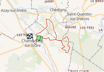
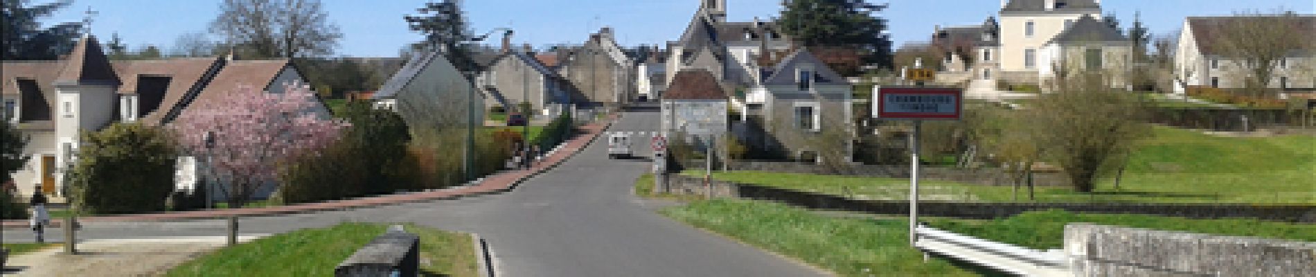
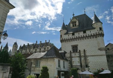
Randonnée Marche de 13,4 km à découvrir à Centre-Val de Loire, Indre-et-Loire, Chambourg-sur-Indre. Cette randonnée est proposée par LEMENIO.

Description

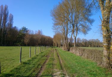
Départ aux abords du stade:  sens de la rando - prendre à gauche après le pont.
         

Profil altimétrique

Photos

Points d'intérêt

Point d'intérêt Chambourg-sur-Indre - Sens rando - Photo
LEMENIO
CHAMBOURG-SUR-INDRE 
Point d'intérêt Saint-Quentin-sur-Indrois - Sens rando - Photo
LEMENIO
SAINT-QUENTIN-SUR-INDROIS 
Point d'intérêt Chambourg-sur-Indre - Cabane - Photo
LEMENIO
CHAMBOURG-SUR-INDRE 
Point d'intérêt Chambourg-sur-Indre - Vue du village - Photo
LEMENIO
CHAMBOURG-SUR-INDRE 

Localisation

Pays :
France
Région :
Centre-Val de Loire
Département/Province :
Indre-et-Loire
Commune :
Chambourg-sur-Indre
Localité :
Unknown
Départ:(Dec)
Départ:(UTM)
346365 ; 5227273 (31T) N.

Randonnées à proximité

Randonnée A pied Chédigny - Circuit Chédigny - Photo
A pied
PRO

A pied

Facile
Chédigny, Centre-Val de Loire, Indre-et-Loire, France
12,8 km | 14,7 km-effort
3h 20min
Oui
Randonnée A pied Chambourg-sur-Indre - Entre Indre et Indrois - Photo
A pied
PRO

A pied

Facile
Chambourg-sur-Indre, Centre-Val de Loire, Indre-et-Loire, France
10,4 km | 12,1 km-effort
2h 45min
Oui
Randonnée Marche Chambourg-sur-Indre - Chambourg-sur-Indre - l'Isle Auger Loches GR46 - 26.7km 325m 5h40 (30mn) - 2021 07 24 - Photo
Marche
Orcal37

Marche

Facile
Chambourg-sur-Indre, Centre-Val de Loire, Indre-et-Loire, France
27 km | 31 km-effort
5h 40min
Oui
Randonnée Marche Azay-sur-Indre - Azay-sur-Indre - GR46 PR Chambourg-sur-Indre - 18.2km 200m 2h55 (23mn) - 2021 03 06 - Photo
Marche
Orcal37

Marche

Facile
Azay-sur-Indre, Centre-Val de Loire, Indre-et-Loire, France
18,2 km | 21 km-effort
3h 55min
Oui
Randonnée Marche Chédigny - Chédigny - Photo
Marche
fustier

Marche

Très difficile
(1)
Chédigny, Centre-Val de Loire, Indre-et-Loire, France
19,5 km | 22 km-effort
4h 53min
Oui
Randonnée V.T.C. Saint-Quentin-sur-Indrois - vallée de l'Indrois Montresor chedigny - Photo
V.T.C.
jeanjean37

V.T.C.

Moyen
Saint-Quentin-sur-Indrois, Centre-Val de Loire, Indre-et-Loire, France
55 km | 64 km-effort
3h 36min
Oui
Randonnée A pied Chédigny - Amboise - J2 G1 - Chédigny et visite du village - Photo
A pied

A pied

Facile
Chédigny, Centre-Val de Loire, Indre-et-Loire, France
15,9 km | 18,2 km-effort
4h 8min
Oui
Randonnée A pied Reignac-sur-Indre - Le Dolmen - Photo
A pied
PRO

A pied

Facile
Reignac-sur-Indre, Centre-Val de Loire, Indre-et-Loire, France
3,3 km | 3,5 km-effort
47min
Non
Randonnée Marche Chédigny - Chédigny-14 Km- Le 21 Mai 2015-Auteur tintin37 - Photo
Marche
Martinjeanclaude

Marche

Facile
Chédigny, Centre-Val de Loire, Indre-et-Loire, France
14 km | 15,7 km-effort
3h 28min
Oui


Fermer
Mes abonnements