tracegps

Offline

Randonnées

Randonnée Marche Bussière-Dunoise - Circuit de Bussière-Dunoise - Photo
Marche
tracegps

Marche

Facile
Bussière-Dunoise, Nouvelle-Aquitaine, Creuse, France
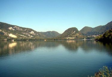
7,8 km | 10,5 km-effort
2h 0min
Oui
Randonnée Marche Ajain - Circuit d'Ajain - Photo
Marche
tracegps

Marche

Difficile
Ajain, Nouvelle-Aquitaine, Creuse, France
12,4 km | 14,6 km-effort
3h 4min
Oui
Randonnée Vélo Val-Suran - Ponts des Vents - St Julien - Photo
Vélo
tracegps

Vélo

Moyen
(1)
Val-Suran, Bourgogne-Franche-Comté, Jura, France
22 km | 26 km-effort
1h 37min
Oui
Randonnée Vélo Saint-Hymetière-sur-Valouse - Vallée de la Valouse - Saint-Hymetière - Photo
Vélo
tracegps

Vélo

Moyen
Saint-Hymetière-sur-Valouse, Bourgogne-Franche-Comté, Jura, France
19,8 km | 26 km-effort
1h 40min
Oui
Randonnée Marche Saumane - Sentier de l'Exil - Saumane - Photo
Marche
tracegps

Marche

Difficile
(1)
Saumane, Occitanie, Gard, France
12,8 km | 19,1 km-effort
4h 0min
Oui
Randonnée Vélo Thoirette-Coisia - Barrages et lac de Coiselet - Thoirette - Photo
Vélo
tracegps

Vélo

Difficile
Thoirette-Coisia, Bourgogne-Franche-Comté, Jura, France
55 km | 67 km-effort
4h 0min
Oui
Randonnée V.T.T. Saint-Loup - Chemin des lavandiéres - Saint-Loup - Photo
V.T.T.
tracegps

V.T.T.

Facile
Saint-Loup, Nouvelle-Aquitaine, Creuse, France
3,8 km | 4,3 km-effort
19min
Oui
Randonnée Marche Saint-Loup - Chemin des lavandiéres - Saint-Loup - Photo
Marche
tracegps

Marche

Facile
Saint-Loup, Nouvelle-Aquitaine, Creuse, France
3,8 km | 4,3 km-effort
1h 0min
Oui
Randonnée Marche Gigors - La tête de la Plane et la dent de Gigors - Photo
Marche
tracegps

Marche

Difficile
(1)
Gigors, Provence-Alpes-Côte d'Azur, Alpes-de-Haute-Provence, France
6,8 km | 15 km-effort
3h 30min
Oui
Randonnée Vélo Arinthod - Autour d'Arinthod  - Photo
Vélo
tracegps

Vélo

Difficile
(1)
Arinthod, Bourgogne-Franche-Comté, Jura, France
28 km | 37 km-effort
2h 25min
Oui
Randonnée Marche Saumane - Sentier du Pont des Chèvres - Saumane - Photo
Marche
tracegps

Marche

Moyen
Saumane, Occitanie, Gard, France
8 km | 13 km-effort
2h 45min
Oui
Randonnée Marche Les Plantiers - Sentier du Rocher de l'Aigle - Photo
Marche
tracegps

Marche

Moyen
Les Plantiers, Occitanie, Gard, France
4,2 km | 7,5 km-effort
3h 0min
Oui
Randonnée Vélo Orgelet - Entre lacs et chapelles - Orgelet - Photo
Vélo
tracegps

Vélo

Difficile
Orgelet, Bourgogne-Franche-Comté, Jura, France
34 km | 43 km-effort
2h 40min
Oui
Randonnée Vélo Clairvaux-les-Lacs - Autour de Claivaux - Photo
Vélo
tracegps

Vélo

Facile
Clairvaux-les-Lacs, Bourgogne-Franche-Comté, Jura, France
14,4 km | 17,1 km-effort
1h 15min
Oui
Randonnée Marche Claret - La tête de Boursier - Claret - Photo
Marche
tracegps

Marche

Difficile
Claret, Provence-Alpes-Côte d'Azur, Alpes-de-Haute-Provence, France
10,8 km | 21 km-effort
4h 30min
Oui
Randonnée Vélo Orgelet -  Escapade médiévale autour d'Orgelet - Photo
Vélo
tracegps

Vélo

Moyen
(1)
Orgelet, Bourgogne-Franche-Comté, Jura, France
26 km | 31 km-effort
1h 49min
Oui
Randonnée Vélo La Tour-du-Meix - Autour du lac de Vouglans - La Tour du Meix - Photo
Vélo
tracegps

Vélo

Moyen
La Tour-du-Meix, Bourgogne-Franche-Comté, Jura, France
31 km | 38 km-effort
2h 10min
Oui
Randonnée Marche Les Plantiers - Sentier de la Palombe -  Les Plantiers - Photo
Marche
tracegps

Marche

Moyen
(1)
Les Plantiers, Occitanie, Gard, France
7,6 km | 12,1 km-effort
3h 0min
Oui
Randonnée Vélo Clairvaux-les-Lacs - Reculée de la Frasnée - Clairvaux-les-Lacs - Photo
Vélo
tracegps

Vélo

Facile
Clairvaux-les-Lacs, Bourgogne-Franche-Comté, Jura, France
13,3 km | 17 km-effort
1h 0min
Oui
Randonnée Marche Saint-André-de-Valborgne - Sentier de l'Escale -  St-André-de-Valborgne - Photo
Marche
tracegps

Marche

Difficile
Saint-André-de-Valborgne, Occitanie, Gard, France
9,6 km | 15,1 km-effort
3h 30min
Oui
Randonnée Vélo Pont-de-Poitte - Riviére d'Ain - Pont de Poitte - Photo
Vélo
tracegps

Vélo

Moyen
Pont-de-Poitte, Bourgogne-Franche-Comté, Jura, France
33 km | 39 km-effort
2h 30min
Oui

Fermer
Mes abonnements