tracegps

Offline

Randonnées

Randonnée Marche Plestin-les-Grèves - Embouchure du Douron - Plestin Les Grèves - Photo
Marche
tracegps

Marche

Moyen
Plestin-les-Grèves, Bretagne, Côtes-d'Armor, France
10,7 km | 12,9 km-effort
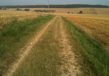
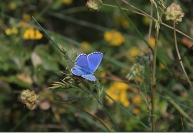
3h 0min
Oui
Randonnée Marche Albertacce - Monte Albanu - Calasima - Photo
Marche
tracegps

Marche

Moyen
Albertacce, Corse, Haute-Corse, France
12,5 km | 25 km-effort
7h 30min
Oui
Randonnée Marche Albertacce - Punta Licciola - Photo
Marche
tracegps

Marche

Moyen
Albertacce, Corse, Haute-Corse, France
12,9 km | 26 km-effort
9h 0min
Oui
Randonnée Marche Grivesnes - Le Langueron - Grivesnes - Photo
Marche
tracegps

Marche

Moyen
Grivesnes, Hauts-de-France, Somme, France
13,2 km | 15,6 km-effort
2h 15min
Oui
Randonnée Marche Vallon-Pont-d'Arc - Vallon Pont d'Arc - Salavas - Photo
Marche
tracegps

Marche

Moyen
(3)
Vallon-Pont-d'Arc, Auvergne-Rhône-Alpes, Ardèche, France
10 km | 14,5 km-effort
3h 0min
Non
Randonnée Marche Chassiers - Visite de Chassiers - Photo
Marche
tracegps

Marche

Moyen
Chassiers, Auvergne-Rhône-Alpes, Ardèche, France
1,1 km | 1,5 km-effort
1h 0min
Oui
Randonnée Marche Chassiers - Balade à Largentière - Photo
Marche
tracegps

Marche

Moyen
Chassiers, Auvergne-Rhône-Alpes, Ardèche, France
4,7 km | 6,4 km-effort
45min
Oui
Randonnée Marche Cappy - Les Champs Muraine - Cappy - Photo
Marche
tracegps

Marche

Moyen
Cappy, Hauts-de-France, Somme, France
9,9 km | 11,9 km-effort
2h 15min
Oui
Randonnée V.T.T. Ploumoguer - Rando VTT de 88 Km autour de Ploumoguer - Photo
V.T.T.
tracegps

V.T.T.

Difficile
Ploumoguer, Bretagne, Finistère, France
86 km | 99 km-effort
6h 0min
Oui
Randonnée V.T.T. Holnon - Les sentiers vermandois - Holnon - Photo
V.T.T.
tracegps

V.T.T.

Moyen
(1)
Holnon, Hauts-de-France, Aisne, France
26 km | 30 km-effort
2h 19min
Oui
Randonnée Marche Chambon-sur-Lac - Lac Chambon - Courbanges - Photo
Marche
tracegps

Marche

Difficile
Chambon-sur-Lac, Auvergne-Rhône-Alpes, Puy-de-Dôme, France
16,2 km | 24 km-effort
5h 0min
Oui
Randonnée V.T.T. Saint-Gérand-le-Puy - 1ère Saint-Gérando VTT (60 km) - Saint Gérand le Puy - Photo
V.T.T.
tracegps

V.T.T.

Moyen
Saint-Gérand-le-Puy, Auvergne-Rhône-Alpes, Allier, France
58 km | 69 km-effort
4h 0min
Oui
Randonnée Marche Rémilly - Remilly et le Haut de Saint-Pierre - Photo
Marche
tracegps

Marche

Moyen
Rémilly, Grand Est, Moselle, France
21 km | 25 km-effort
5h 30min
Oui
Randonnée Marche Heiligenstein - De Heiligenstein au Mont Sainte Odile - Photo
Marche
tracegps

Marche

Moyen
(1)
Heiligenstein, Grand Est, Bas-Rhin, France
13,3 km | 22 km-effort
3h 30min
Oui
Randonnée Course à pied Ploemel - Tour de Ploemel - Ploemel  - Photo
Course à pied
tracegps

Course à pied

Difficile
Ploemel, Bretagne, Morbihan, France
16,2 km | 17,8 km-effort
1h 30min
Oui
Randonnée V.T.T. Ploemel - Tour de Ploemel - Ploemel  - Photo
V.T.T.
tracegps

V.T.T.

Moyen
Ploemel, Bretagne, Morbihan, France
16,2 km | 17,8 km-effort
45min
Oui
Randonnée Marche Ploemel - Tour de Ploemel - Ploemel  - Photo
Marche
tracegps

Marche

Moyen
Ploemel, Bretagne, Morbihan, France
16,2 km | 17,8 km-effort
3h 30min
Oui
Randonnée Autre activité Charny-sur-Meuse - La Meuse de Charny sur Meuse à Regnéville - Photo
Autre activité
tracegps

Autre activité

Moyen
Charny-sur-Meuse, Grand Est, Meuse, France
15 km | 16,2 km-effort
2h 30min
Non
Randonnée Autre activité Les Monthairons - La Meuse de Monthairons à Belleray - Photo
Autre activité
tracegps

Autre activité

Moyen
Les Monthairons, Grand Est, Meuse, France
15,4 km | 16,9 km-effort
2h 30min
Non
Randonnée V.T.T. Maisod - Lac de Vouglans sud - Maisod     - Photo
V.T.T.
tracegps

V.T.T.

Difficile
Maisod, Bourgogne-Franche-Comté, Jura, France
54 km | 69 km-effort
4h 30min
Oui
Randonnée V.T.T. Saint-Just-Saint-Rambert - Du Barrage de Villerest au Barrage de Grangent en 10 boucles / Boucle N° 10 : Pont de Saint-Just-Saint-Rambert - Barrage de Grangent - Photo
V.T.T.
tracegps

V.T.T.

Très difficile
Saint-Just-Saint-Rambert, Auvergne-Rhône-Alpes, Loire, France
17,7 km | 23 km-effort
2h 30min
Oui

Fermer
Mes abonnements