


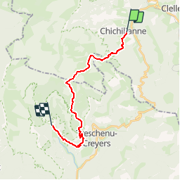

10.2 km | 17.1 km-effort


FREE GPS app for hiking
 SityTrail
IGN / Geographical institutes
SityTrail World
The world is yours!
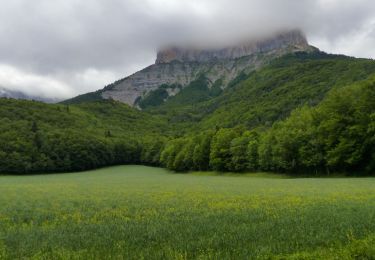
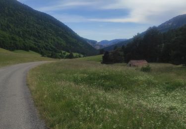
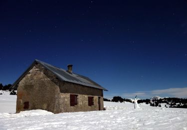
Trail Snowshoes of 18.9 km to be discovered at Auvergne-Rhône-Alpes, Isère, Chichilianne. This trail is proposed by jerome-dupont@laposte.net.
traversée en une journée dans le vercors
Walking

Walking

Walking

Walking
Walking
Walking
Walking
Walking
On foot
en même temps c'est ma carte:-)