Trail Walking Chichilianne - Tete de Praortzel et Crête de Grande Leirie - Photo

Tete de Praortzel et Crête de Grande Leirie

 patjobou
patjobou

User

© OpenStreetMap contributors
Length
Length
12.4 km
Max alt
Max alt
1672 m
Uphill gradient
Uphill gradient
641 m
Km-Effort
Km-Effort  
21 km
Min alt
Min alt
1138 m
Downhill gradient
Downhill gradient
641 m
Boucle
Boucle
Yes
Creation date :
2019-06-27 06:12:16.029
Updated on :
2019-07-09 19:09:43.266

(0 Reviews)

Walking
Walking
5h39
Difficulty : Difficult

Scan this QR Code to open this trail in the SityTrail application

FREE GPS app for hiking

Logo SityTrail SityTrail

IGN / Geographical institutes

Download SityTrail from the App Store Download SityTrail from Google Play

Logo SityTrail SityTrail World

The world is yours!

Download SityTrail from the App Store Download SityTrail from Google Play Download SityTrail on Huawei AppGallery

About

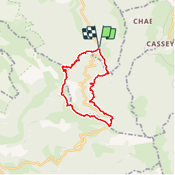
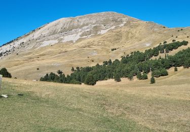
Trail Walking of 12.4 km to be discovered at Auvergne-Rhône-Alpes, Isère, Chichilianne. This trail is proposed by patjobou.

Description

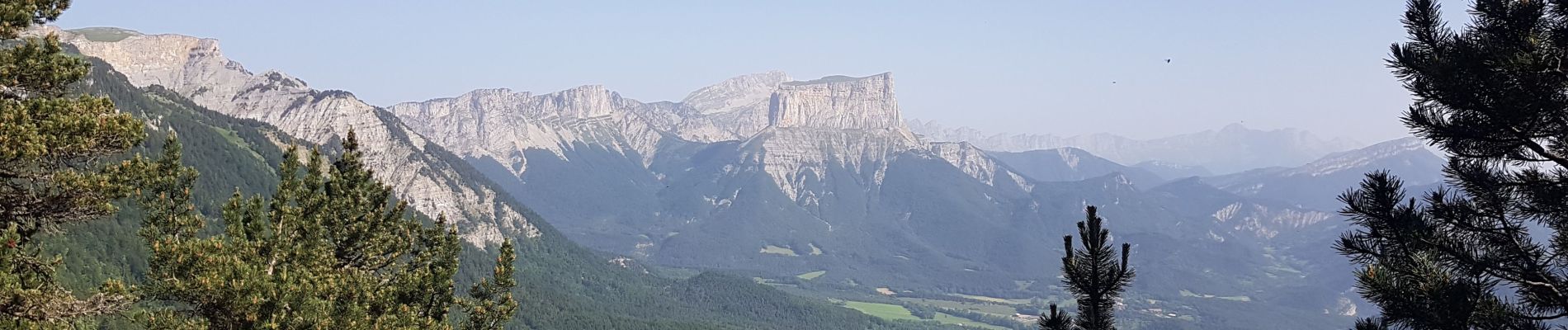
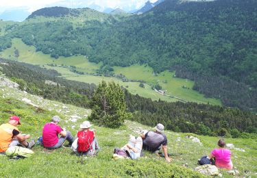
Très belle boucle en Sud Vercors; superbes vues sur la barrière Est; prairies très fleuries à cette époque (fin juin); nous avons même trouvé du muguet en fleurs!
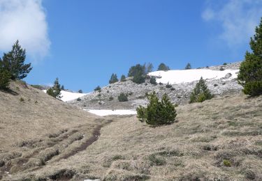
La montée à la Tête de Praortzel se fait par un bon sentier bien tracé, essentiellement en foret. Quelques passages exposés demandent cependant de la prudence et un pied sûr. La descente par les Crêtes de Lieirie est sans problème, avec des passages à vue; bonne visibilité
fortement conseillée. La traversée entre le Col de Menée (pt 1396m) et le ruisseau d'Esparron (pt 1212) se fait par un ancien sentier plus ou moins balisé, non entretenu, mais 'encore visible'. La suite est classique. Classé quand même difficile malgré le faible dénivellé.

Elevation profile

Photos

Positioning

Country:
France
Region :
Auvergne-Rhône-Alpes
Department/Province :
Isère
Municipality :
Chichilianne
Location:
Unknown
Start:(UTM)
705575 ; 4962428 (31T) N.

Trails nearby

Trail Walking Châtillon-en-Diois - Combau-TêteChevalière 05-05-2018 - Photo
Walking
Philindy26

Walking

Easy
(4)
Châtillon-en-Diois, Auvergne-Rhône-Alpes, Drôme, France
10.2 km | 17.1 km-effort
4h 0min
Yes
Trail Walking Châtillon-en-Diois - F26 Combau Fontaine Pourrie - Photo
Walking
ageo

Walking

Medium
(1)
Châtillon-en-Diois, Auvergne-Rhône-Alpes, Drôme, France
17 km | 29 km-effort
6h 9min
Yes
Trail Walking Chichilianne - Le Platary - Photo
Walking
patjobou

Walking

Medium
(2)
Chichilianne, Auvergne-Rhône-Alpes, Isère, France
6.6 km | 12.1 km-effort
2h 29min
Yes
Trail Walking Chichilianne - La Fontaine Pourrie - Hauts Plateaux Sud du Vercors - Photo
Walking
tracegps

Walking

Medium
(2)
Chichilianne, Auvergne-Rhône-Alpes, Isère, France
19.4 km | 33 km-effort
7h 45min
Yes
Trail Walking Châtillon-en-Diois - 2017-06-04 15:45:22 - Photo
Walking
randochu

Walking

Medium
(1)
Châtillon-en-Diois, Auvergne-Rhône-Alpes, Drôme, France
11.4 km | 19.9 km-effort
Unknown
Yes
Trail Walking Châtillon-en-Diois - La boucle du Mont Barral - Photo
Walking
GUIDE
R@ph

Walking

Difficult
Châtillon-en-Diois, Auvergne-Rhône-Alpes, Drôme, France
7.5 km | 14.9 km-effort
3h 7min
Yes
Trail Snowshoes Chichilianne - chichilianne archiane - Photo
Snowshoes
jerome-dupont@laposte.net

Snowshoes

Medium
(1)
Chichilianne, Auvergne-Rhône-Alpes, Isère, France
18.9 km | 32 km-effort
8h 0min
No
Trail Walking Châtillon-en-Diois - mont barral - Photo
Walking
scalpy

Walking

Difficult
Châtillon-en-Diois, Auvergne-Rhône-Alpes, Drôme, France
7.7 km | 15 km-effort
4h 8min
Yes
Trail Walking Châtillon-en-Diois - 26 vallon combeau - Photo
Walking
himba26100

Walking

Medium
Châtillon-en-Diois, Auvergne-Rhône-Alpes, Drôme, France
13.3 km | 24 km-effort
6h 48min
Yes


Close
My subscriptions