Trail Mountain bike Chorges - Espace VTT FFC de Serre-Ponçon - Durance - Circuit n°09 - La Croix des Prés - Photo

Espace VTT FFC de Serre-Ponçon - Durance - Circuit n°09 - La Croix des Prés

 tracegps
tracegps

User

© OpenStreetMap contributors
Length
Length
15.6 km
Max alt
Max alt
1444 m
Uphill gradient
Uphill gradient
566 m
Km-Effort
Km-Effort  
23 km
Min alt
Min alt
926 m
Downhill gradient
Downhill gradient
563 m
Boucle
Boucle
Yes
Creation date :
2014-12-10 00:00:00.0
Updated on :
2014-12-10 00:00:00.0

(0 Reviews)

Mountain bike
Mountain bike
2h00
Difficulty : Difficult

Scan this QR Code to open this trail in the SityTrail application

FREE GPS app for hiking

Logo SityTrail SityTrail

IGN / Geographical institutes

Download SityTrail from the App Store Download SityTrail from Google Play

Logo SityTrail SityTrail World

The world is yours!

Download SityTrail from the App Store Download SityTrail from Google Play Download SityTrail on Huawei AppGallery

About

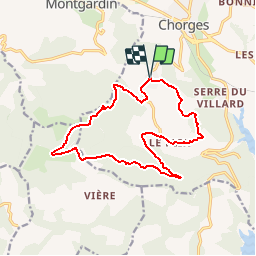
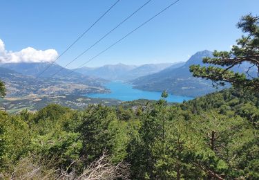
Trail Mountain bike of 15.6 km to be discovered at Provence-Alpes-Côte d'Azur, Hautes-Alpes, Chorges. This trail is proposed by tracegps.

Description

Espace VTT FFC de Serre-Ponçon - Durance Circuit labellisé par la Fédération Française de Cyclisme. Départ depuis le hameau des Oliviers, au sud de Chorges. Circuit roulant en boucle sur pistes. Montée raide sur la première partie du parcours. Liaison de 4 km avec le circuit n° 11 au carrefour de la Croix des Prés. Prudence dans la descente. Parcours varié, champêtre et forestier. Aire de pique-nique de la Croix des Prés. Chapelle des hameaux des Oliviers et du Fein. Le carrefour de la Croix des Prés permet l’accès par des pistes à Chorges, le mont Colombis, Avançon, l’ancien hameau de Vières et Rousset, le col Lebraut.
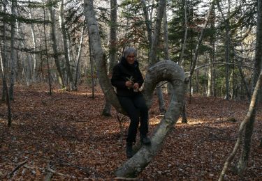
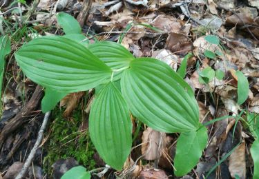
Elevation profile

Photos

Positioning

Country:
France
Region :
Provence-Alpes-Côte d'Azur
Department/Province :
Hautes-Alpes
Municipality :
Chorges
Location:
Unknown
Start:(UTM)
282591 ; 4934592 (32T) N.

Trails nearby

Trail Walking Chorges - Chanteloube et lac de Serre Ponçon - Photo
Walking
gildascb

Walking

Very easy
(2)
Chorges, Provence-Alpes-Côte d'Azur, Hautes-Alpes, France
5.9 km | 8.2 km-effort
1h 47min
Yes
Trail Walking Chorges - clôt c l'avais sur fein - Photo
Walking
Didier.kiehl

Walking

Very easy
(2)
Chorges, Provence-Alpes-Côte d'Azur, Hautes-Alpes, France
8 km | 12.6 km-effort
2h 24min
Yes
Trail Walking Chorges - Les Parias et la Pousterle par le col de Chorges - Photo
Walking
GUIDE
David25400

Walking

Medium
Chorges, Provence-Alpes-Côte d'Azur, Hautes-Alpes, France
15.4 km | 32 km-effort
6h 18min
Yes
Trail Walking Chorges - Montagne du Ruban - Photo
Walking
BLANCHET

Walking

Easy
(2)
Chorges, Provence-Alpes-Côte d'Azur, Hautes-Alpes, France
11 km | 17.4 km-effort
3h 39min
No
Trail Walking Chorges - CHORGES camping clé des champs Cantheloube retour par le nord - Photo
Walking
jll7513

Walking

Easy
Chorges, Provence-Alpes-Côte d'Azur, Hautes-Alpes, France
8.7 km | 12.1 km-effort
2h 44min
Yes
Trail Walking Le Sauze-du-Lac - La Pierre d'Arnaud 231121 - Photo
Walking
GUIDE
David25400

Walking

Very easy
Le Sauze-du-Lac, Provence-Alpes-Côte d'Azur, Hautes-Alpes, France
6.4 km | 9 km-effort
2h 18min
No
Trail Walking Le Sauze-du-Lac - balcons du lac 171121 - Photo
Walking
GUIDE
David25400

Walking

Very easy
Le Sauze-du-Lac, Provence-Alpes-Côte d'Azur, Hautes-Alpes, France
5.5 km | 8 km-effort
1h 29min
No
Trail Walking Le Sauze-du-Lac - balcons du lac 270921 - Photo
Walking
GUIDE
David25400

Walking

Very easy
Le Sauze-du-Lac, Provence-Alpes-Côte d'Azur, Hautes-Alpes, France
3.3 km | 5 km-effort
1h 57min
Yes
Trail Walking Chorges - Bois du Ruban (Clot Clavary - crête du Ruban) - Photo
Walking
gildascb

Walking

Easy
Chorges, Provence-Alpes-Côte d'Azur, Hautes-Alpes, France
12.1 km | 19.3 km-effort
3h 52min
Yes


Close
My subscriptions