Trail Walking Sixt-Fer-à-Cheval - Traversée Vogealle - Folly - Photo
 tracegps
tracegps

User

© OpenStreetMap contributors
Length
Length
15.8 km
Max alt
Max alt
2338 m
Uphill gradient
Uphill gradient
1463 m
Km-Effort
Km-Effort  
36 km
Min alt
Min alt
832 m
Downhill gradient
Downhill gradient
1534 m
Boucle
Boucle
No
Creation date :
2014-12-10 00:00:00.0
Updated on :
2014-12-10 00:00:00.0

(0 Reviews)

Walking
Walking
7h00
Difficulty : Difficult

Scan this QR Code to open this trail in the SityTrail application

FREE GPS app for hiking

Logo SityTrail SityTrail

IGN / Geographical institutes

Download SityTrail from the App Store Download SityTrail from Google Play

Logo SityTrail SityTrail World

The world is yours!

Download SityTrail from the App Store Download SityTrail from Google Play Download SityTrail on Huawei AppGallery

About

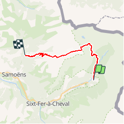
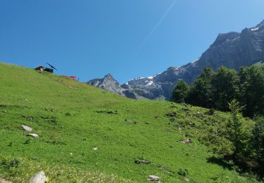
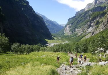
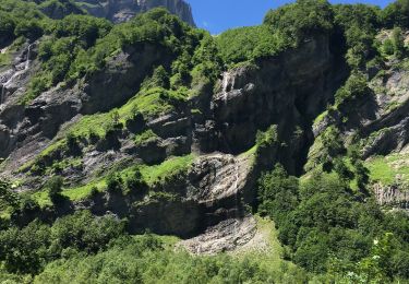
Trail Walking of 15.8 km to be discovered at Auvergne-Rhône-Alpes, Upper Savoy, Sixt-Fer-à-Cheval. This trail is proposed by tracegps.

Description

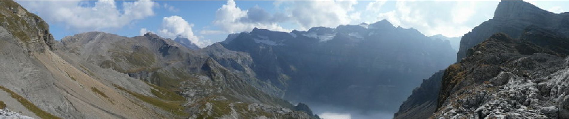
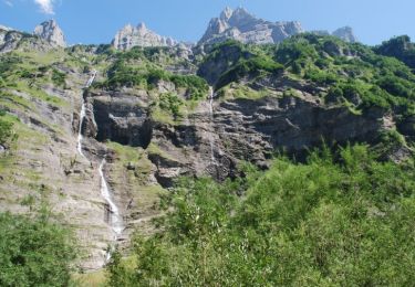
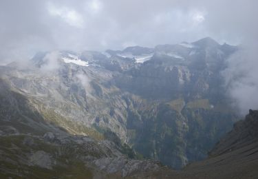
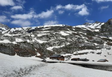
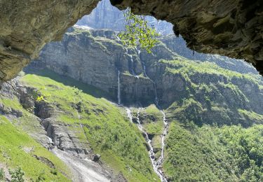
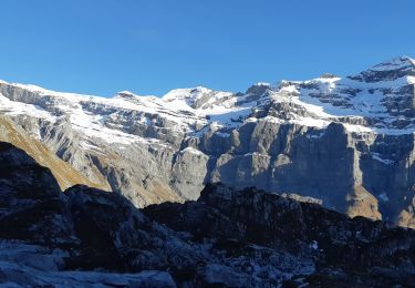
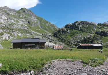
Départ : Rejoindre le parking du Fer à Cheval à Sixt Fer à Cheval. Pensez à laisser un véhicule au parking du pied du Crêt au dessus de Samoëns avant le hameau des Allamands. Itinéraire : Dans un premier temps, rejoignez la buvette du Prazon dans la combe du Fer à Cheval. Un p'tit coucou à Yvette et Patrice et ensuite on bifurque sur le pas du Boret. Ce passage est parfois un peu aérien et peu s'avérer glissant par temps de pluie. Si vous ne le sentez pas, il est préférable d'emprunter la montée par le bout du monde qui rallonge un peu la durée et la distance. Une fois rejoint la buvette du Boret, un p'tit coucou à Sylvie et Hubert (vous allez voir, les coucous ne manque pas le long de cette ballade) et on grimpe direction le refuge de la Vogealle afin d'aller voir Doriane et Domi. Arrêtez vous pour manger un bout ou pour passer la nuit, vous verrez, vous ne serez pas décus. Ensuite il existe deux variantes : utiliser la combe au Puaires ou passer par les chambres. C'est cette solution que j'ai choisie. Donc direction le lac de la Vogealle et bien avant de voir celui-ci, on bifurque à gauche afin d'emprunter le pas à l'ours. Faites gaffes, c'est du schiste tout délité, ça peut glisser. De là on rejoint le col des chambres puis on bascule dans le vallon des chambres direction le lac et le gouffre Jean Bernard. Ambiance lunaire au programme. Il ne reste plus qu'à descendre au refuge du Folly (p'tit couc à Jean) et on rejoint la vallée au parking du pied du Crêt afin de retrouver la voiture.

Elevation profile

Photos

Positioning

Country:
France
Region :
Auvergne-Rhône-Alpes
Department/Province :
Upper Savoy
Municipality :
Sixt-Fer-à-Cheval
Location:
Unknown
Start:(UTM)
333025 ; 5104991 (32T) N.

Trails nearby

Trail Walking Sixt-Fer-à-Cheval - Sixt Fer à Cheval et cascades - Photo
Walking
tracegps

Walking

Medium
(3)
Sixt-Fer-à-Cheval, Auvergne-Rhône-Alpes, Upper Savoy, France
9.3 km | 14.1 km-effort
3h 0min
Yes
Trail On foot Sixt-Fer-à-Cheval - GR de Pays Tour des Dents Blanches - Photo
On foot
PRO

On foot

Very difficult
Sixt-Fer-à-Cheval, Auvergne-Rhône-Alpes, Upper Savoy, France
41 km | 87 km-effort
19h 51min
Yes
Trail Walking Sixt-Fer-à-Cheval - Refuge de Vogealle et Bout du monde - Photo
Walking
GuyVachet

Walking

Very difficult
Sixt-Fer-à-Cheval, Auvergne-Rhône-Alpes, Upper Savoy, France
16 km | 30 km-effort
5h 50min
Yes
Trail Walking Sixt-Fer-à-Cheval - Le bout du monde Sixt fer à cheval - Photo
Walking
daniel34

Walking

Medium
Sixt-Fer-à-Cheval, Auvergne-Rhône-Alpes, Upper Savoy, France
11.9 km | 18.7 km-effort
3h 10min
Yes
Trail Walking Sixt-Fer-à-Cheval - lac de la Vogealle par le pas du Boret - Photo
Walking
arianespace

Walking

Difficult
Sixt-Fer-à-Cheval, Auvergne-Rhône-Alpes, Upper Savoy, France
19.2 km | 35 km-effort
8h 0min
Yes
Trail Walking Sixt-Fer-à-Cheval - SIXT-PASSY: PAS DU BORET - VOGEALLE - BOUT DU MONDE - Photo
Walking
djeepee74

Walking

Difficult
Sixt-Fer-à-Cheval, Auvergne-Rhône-Alpes, Upper Savoy, France
15.1 km | 30 km-effort
6h 15min
Yes
Trail Walking Sixt-Fer-à-Cheval - SIXT PASSY: PAS DU BORET - BOUT DU MONDE - Photo
Walking
djeepee74

Walking

Difficult
Sixt-Fer-à-Cheval, Auvergne-Rhône-Alpes, Upper Savoy, France
10.7 km | 18 km-effort
3h 45min
Yes
Trail Fishing Sixt-Fer-à-Cheval - Sixt fer à cheval - Photo
Fishing
jeff2

Fishing

Very easy
Sixt-Fer-à-Cheval, Auvergne-Rhône-Alpes, Upper Savoy, France
12.1 km | 17.9 km-effort
3h 37min
No
Trail Walking Sixt-Fer-à-Cheval - Randonnée du Bout du Monde - Photo
Walking
so.duchateau

Walking

Medium
Sixt-Fer-à-Cheval, Auvergne-Rhône-Alpes, Upper Savoy, France
10.7 km | 16.1 km-effort
3h 21min
No


Close
My subscriptions