Trail Walking Laruns - Le pic d'Arriel 2824m depuis le caillou de Soques - Photo

Le pic d'Arriel 2824m depuis le caillou de Soques

 tracegps
tracegps

User

© OpenStreetMap contributors
Length
Length
12.7 km
Max alt
Max alt
2809 m
Uphill gradient
Uphill gradient
1382 m
Km-Effort
Km-Effort  
31 km
Min alt
Min alt
1399 m
Downhill gradient
Downhill gradient
1382 m
Boucle
Boucle
Yes
Creation date :
2014-12-10 00:00:00.0
Updated on :
2014-12-10 00:00:00.0

(0 Reviews)

Walking
Walking
6h15
Difficulty : Very difficult

Scan this QR Code to open this trail in the SityTrail application

FREE GPS app for hiking

Logo SityTrail SityTrail

IGN / Geographical institutes

Download SityTrail from the App Store Download SityTrail from Google Play

Logo SityTrail SityTrail World

The world is yours!

Download SityTrail from the App Store Download SityTrail from Google Play Download SityTrail on Huawei AppGallery

About

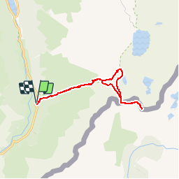
Trail Walking of 12.7 km to be discovered at New Aquitaine, Pyrénées-Atlantiques, Laruns. This trail is proposed by tracegps.

Description

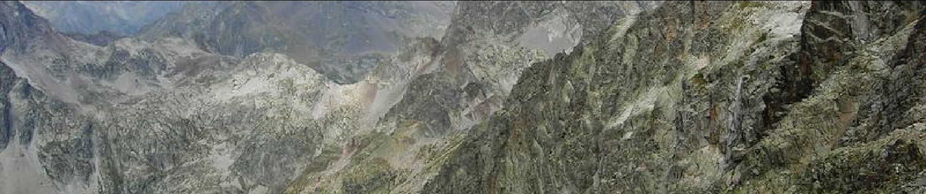
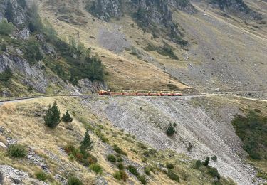
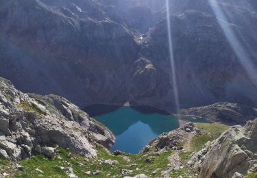
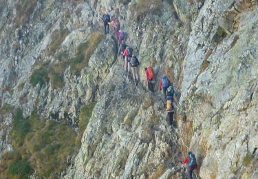
Le pic d'Arriel 2824m depuis le caillou de Soques (1390m) Très élégant et même impressionnant quand on l'admire depuis Arrémoulit, le pic d'Arriel, sur la frontière, constitue un remarquable belvédère, sans difficulté réelle, même si l'arête finale demande un peu d'aide des mains. Quand on a l'intention de faire le Palas (ou le Balaitous) après une nuit au refuge d'Arrémoulit, il est astucieux, le premier jour, de s'offrir l'Arriel qui mérite bien en petit détour ! Difficultés: Arête finale ou il faut mettre un peu les mains; en début d'été, crampons et piolet sont nécessaires car subsistent des portions enneigées. D’autres indications, photos et panoramiques sur le site « Les Pyrénées vues par Mariano ».

Elevation profile

Photos

Positioning

Country:
France
Region :
New Aquitaine
Department/Province :
Pyrénées-Atlantiques
Municipality :
Laruns
Location:
Unknown
Start:(Dec)
Start:(UTM)
713877 ; 4745995 (30T) N.

Trails nearby

Trail Walking Laruns - Pic de Canaourouye et Pic d'Anéou - Photo
Walking
tracegps

Walking

Difficult
(1)
Laruns, New Aquitaine, Pyrénées-Atlantiques, France
10.6 km | 19.3 km-effort
3h 30min
Yes
Trail Walking Laruns - Lac de barége  - Photo
Walking
ombrabella

Walking

Easy
Laruns, New Aquitaine, Pyrénées-Atlantiques, France
12.6 km | 19.1 km-effort
1h 53min
No
Trail Walking Laruns - Lac d’Arrious - Petit Arriel - Col de Sobe_Octobre 2022 - Photo
Walking
Bearn64230

Walking

Very difficult
Laruns, New Aquitaine, Pyrénées-Atlantiques, France
14.1 km | 31 km-effort
7h 24min
Yes
Trail Walking Laruns - Pic de Balaïtous depuis le caillou de Soques a/r - Photo
Walking
PVERTICAL

Walking

Very difficult
Laruns, New Aquitaine, Pyrénées-Atlantiques, France
24 km | 56 km-effort
15h 0min
Yes
Trail On foot Laruns - Wikiloc - CABANE DE SOQUE REFUGE D'ARREMOULIT VIA LE PASSAGE D'ORTEIG 23 JUILLET 2018 - Photo
On foot
ETMU5496

On foot

Very difficult
Laruns, New Aquitaine, Pyrénées-Atlantiques, France
15 km | 31 km-effort
Unknown
Yes
Trail Snowshoes Laruns - cabane de Cherue - Photo
Snowshoes
PVERTICAL

Snowshoes

Medium
Laruns, New Aquitaine, Pyrénées-Atlantiques, France
6 km | 13.3 km-effort
4h 4min
Yes
Trail Walking Laruns - Lac de Pombie - Photo
Walking
DuMarsan

Walking

Easy
Laruns, New Aquitaine, Pyrénées-Atlantiques, France
11.4 km | 21 km-effort
4h 22min
Yes
Trail Walking Laruns - Le Tour du Peyreget - Gabas - Photo
Walking
tracegps

Walking

Difficult
Laruns, New Aquitaine, Pyrénées-Atlantiques, France
10.3 km | 20 km-effort
6h 0min
Yes
Trail Walking Laruns - Pic d'Estrémère (2165m) par le port de Peyrelue - Photo
Walking
tracegps

Walking

Difficult
Laruns, New Aquitaine, Pyrénées-Atlantiques, France
8.2 km | 16.1 km-effort
3h 30min
Yes


Close
My subscriptions