


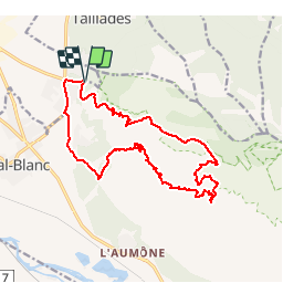

16.7 km | 27 km-effort


User


FREE GPS app for hiking
 SityTrail
IGN / Geographical institutes
SityTrail World
The world is yours!
Trail Mountain bike of 17.4 km to be discovered at Provence-Alpes-Côte d'Azur, Vaucluse, Cheval-Blanc. This trail is proposed by fireman84.
montee de vidok dure du 2 au 3 km,apres descente par le calvaire jusqu au parking regalon(descente avec des passages dangereux dans les cailloux)

Walking

Cycle

Cycle

Cycle

Walking

Walking

Walking
Walking

Mountain bike
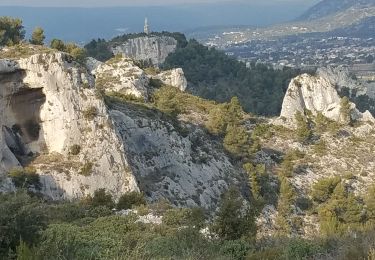
parcours bien sympathique
Superbe parcours offrant des vues exceptionnelles. Belle descente avec alternance de passages roulants et de passages plus techniques.