


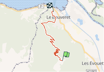

6.3 km | 9.9 km-effort


User


FREE GPS app for hiking
 SityTrail
IGN / Geographical institutes
SityTrail World
The world is yours!
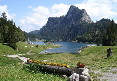
Trail Walking of 5.8 km to be discovered at Valais/Wallis, Monthey, Port-Valais. This trail is proposed by yveshumbert.
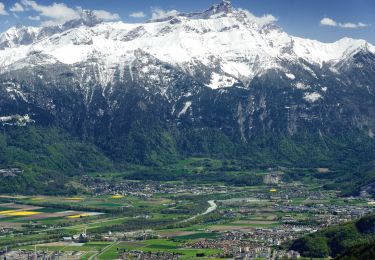
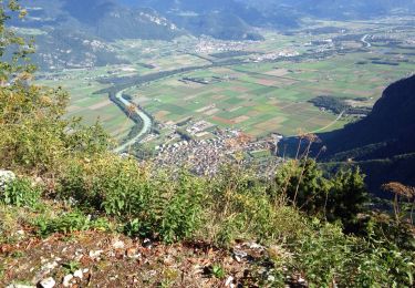
Une bonne ballade pour le début de saison. La montée se fait dans la forêt sans beaucoup du vue.
Celle-ci se dégagera une fois arrivé au sommet. Une très bonne restauration vous attend à la cabane d'alpage de Chalavornaire (téléphonez avant).
On foot
On foot
On foot
Walking
Mountain bike

Other activity
Other activity
Other activity
Other activity