Trail Via ferrata Port-Valais - Lac Taney - Photo
 Marginal
Marginal

User

© OpenStreetMap contributors
Length
Length
22 km
Max alt
Max alt
1784 m
Uphill gradient
Uphill gradient
1482 m
Km-Effort
Km-Effort  
41 km
Min alt
Min alt
371 m
Downhill gradient
Downhill gradient
1486 m
Boucle
Boucle
Yes
Creation date :
2014-12-11 00:00:00.0
Updated on :
2014-12-11 00:00:00.0

(0 Reviews)

Via ferrata
Via ferrata
--
Difficulty : Unknown

Scan this QR Code to open this trail in the SityTrail application

FREE GPS app for hiking

Logo SityTrail SityTrail

IGN / Geographical institutes

Download SityTrail from the App Store Download SityTrail from Google Play

Logo SityTrail SityTrail World

The world is yours!

Download SityTrail from the App Store Download SityTrail from Google Play Download SityTrail on Huawei AppGallery

About

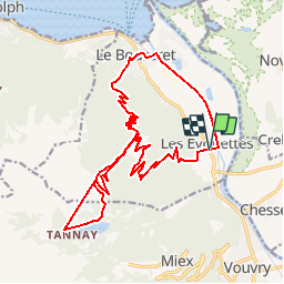
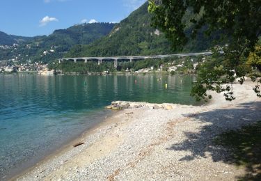
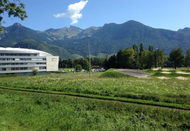
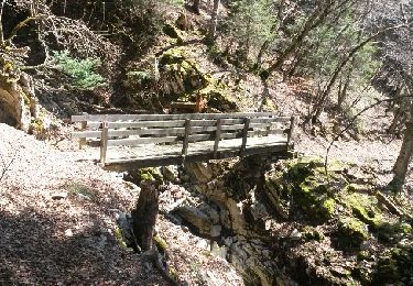
Trail Via ferrata of 22 km to be discovered at Valais/Wallis, Monthey, Port-Valais. This trail is proposed by Marginal.

Description

Des Evouettes au Lac Tanay

Elevation profile

Positioning

Country:
Switzerland
Region :
Valais/Wallis
Department/Province :
Monthey
Municipality :
Port-Valais
Location:
Unknown
Start:(UTM)
336693 ; 5136525 (32T) N.

Trails nearby

Trail On foot Vouvry - Miex-Lac Tanay (via Prélagine) - Photo
On foot
PRO

On foot

Easy
Vouvry, Valais/Wallis, Monthey, Switzerland
6.3 km | 9.9 km-effort
2h 15min
No
Trail On foot Vionnaz - Torgon village - Chalet de Blancsex - Photo
On foot
PRO

On foot

Easy
Vionnaz, Valais/Wallis, Monthey, Switzerland
4.4 km | 8.7 km-effort
1h 58min
No
Trail On foot Vionnaz - Torgon village - Dravers - Photo
On foot
PRO

On foot

Easy
Vionnaz, Valais/Wallis, Monthey, Switzerland
4 km | 8.3 km-effort
1h 53min
No
Trail Walking Vouvry - Lac Tanay - Photo
Walking
danihz

Walking

Medium
Vouvry, Valais/Wallis, Monthey, Switzerland
12.4 km | 22 km-effort
4h 45min
Yes
Trail Walking Villeneuve (VD) - Bois de Chillon - Photo
Walking
danihz

Walking

Easy
Villeneuve (VD), Vaud, District d'Aigle, Switzerland
10.6 km | 16.1 km-effort
2h 30min
Yes
Trail Cycle Villeneuve (VD) - Coteaux du Chablais - Berge du Rhõne - Photo
Cycle
danihz

Cycle

Medium
Villeneuve (VD), Vaud, District d'Aigle, Switzerland
50 km | 59 km-effort
2h 24min
No
Trail Walking Roche (VD) - Boucle d Arvel Joux Verte  - Photo
Walking
pawenger

Walking

Medium
Roche (VD), Vaud, District d'Aigle, Switzerland
6.9 km | 18.7 km-effort
1h 44min
Yes
Trail On foot Villeneuve (VD) - La balade des hameaux - Photo
On foot
famiski

On foot

Easy
Villeneuve (VD), Vaud, District d'Aigle, Switzerland
6.6 km | 10.5 km-effort
2h 22min
Yes
Trail On foot Villeneuve (VD) - Les Grangettes - Photo
On foot
famiski

On foot

Easy
Villeneuve (VD), Vaud, District d'Aigle, Switzerland
8.2 km | 9 km-effort
2h 2min
Yes


Close
My subscriptions