Trail Walking Lus-la-Croix-Haute - L Aiguille ou Le Haut Bouffet - Photo

L Aiguille ou Le Haut Bouffet

 patjobou
patjobou

User

© OpenStreetMap contributors
Length
Length
10.7 km
Max alt
Max alt
2094 m
Uphill gradient
Uphill gradient
957 m
Km-Effort
Km-Effort  
23 km
Min alt
Min alt
1179 m
Downhill gradient
Downhill gradient
952 m
Boucle
Boucle
Yes
Creation date :
2018-09-13 07:00:22.801
Updated on :
2018-09-13 20:12:40.918

(0 Reviews)

Walking
Walking
6h00
Difficulty : Medium

Scan this QR Code to open this trail in the SityTrail application

FREE GPS app for hiking

Logo SityTrail SityTrail

IGN / Geographical institutes

Download SityTrail from the App Store Download SityTrail from Google Play

Logo SityTrail SityTrail World

The world is yours!

Download SityTrail from the App Store Download SityTrail from Google Play Download SityTrail on Huawei AppGallery

About

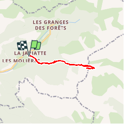
Trail Walking of 10.7 km to be discovered at Auvergne-Rhône-Alpes, Drôme, Lus-la-Croix-Haute. This trail is proposed by patjobou.

Description

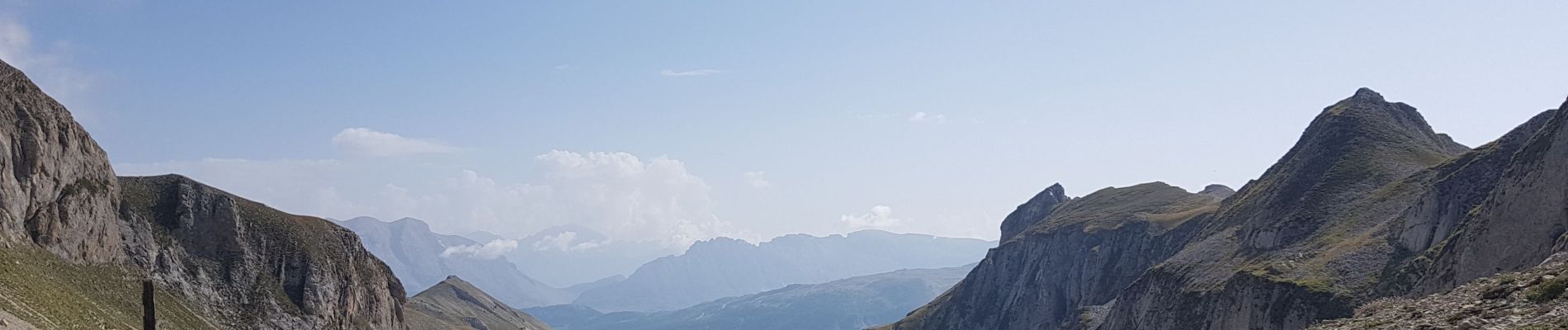
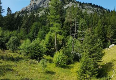
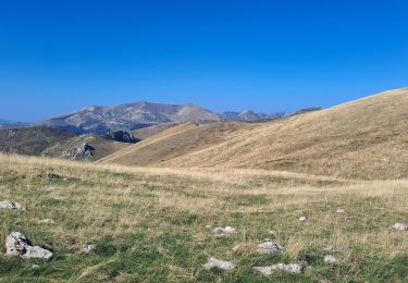
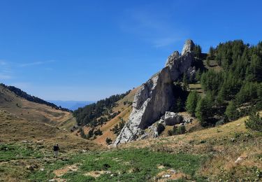
Une belle pointe que l'on n'imaginerait pas gravir depuis La Jarjatte. La montée au col des l'Aiguilles est soutenue, mais régulière. Au col superbe vue sur le Vallon des Aiguilles vers l'Est. Le chemin vers la cote 2052m par dans la direction SEE, il franchit aisément un petit passage rocheux. Au point 2052m, on aperçoit le sommet vers l'Ouest. Un passage rocheux peu paraître inquiétant; s'engager en suivant les cairns, et ça passe de vire en vires. Après un antécime, on accède au sommet par une pente herbeuse soutenue. D'après Pascal Sombardier: Les plus belles randonnées en Triève et Dévoluy, It n°24.

Elevation profile

Photos

Positioning

Country:
France
Region :
Auvergne-Rhône-Alpes
Department/Province :
Drôme
Municipality :
Lus-la-Croix-Haute
Location:
Unknown
Start:(UTM)
718571 ; 4950462 (31T) N.

Trails nearby

Trail Walking Lus-la-Croix-Haute - R48 - Gorges des Amayères - Photo
Walking
GUIDE+

Walking

Easy
Lus-la-Croix-Haute, Auvergne-Rhône-Alpes, Drôme, France
10.3 km | 17.5 km-effort
3h 1min
No
Trail Walking Lus-la-Croix-Haute - R41   le lac de Lauzon - Photo
Walking
GUIDE+

Walking

Difficult
Lus-la-Croix-Haute, Auvergne-Rhône-Alpes, Drôme, France
8.1 km | 18.7 km-effort
3h 40min
Yes
Trail Walking Lus-la-Croix-Haute - R38   Col des Aiguilles depuis Lus - Photo
Walking
GUIDE+

Walking

Medium
Lus-la-Croix-Haute, Auvergne-Rhône-Alpes, Drôme, France
5.6 km | 15 km-effort
2h 53min
Yes
Trail Walking Lus-la-Croix-Haute - R37   Col de la Croix - Photo
Walking
GUIDE+

Walking

Medium
Lus-la-Croix-Haute, Auvergne-Rhône-Alpes, Drôme, France
3.7 km | 7 km-effort
1h 27min
Yes
Trail Walking Lus-la-Croix-Haute - Le Rognon - Photo
Walking
GAPIAN43

Walking

Medium
(1)
Lus-la-Croix-Haute, Auvergne-Rhône-Alpes, Drôme, France
12.3 km | 22 km-effort
4h 33min
Yes
Trail Walking Lus-la-Croix-Haute - Pointe Feuillette - Photo
Walking
Marco05

Walking

Difficult
Lus-la-Croix-Haute, Auvergne-Rhône-Alpes, Drôme, France
10.5 km | 20 km-effort
4h 36min
Yes
Trail Walking Saint-Julien-en-Beauchêne - tour des 4 cols - Photo
Walking
GuyVachet

Walking

Very difficult
Saint-Julien-en-Beauchêne, Provence-Alpes-Côte d'Azur, Hautes-Alpes, France
13.2 km | 24 km-effort
5h 25min
Yes
Trail Walking Lus-la-Croix-Haute - Pointe feuillette  - Photo
Walking
ajd26

Walking

Medium
Lus-la-Croix-Haute, Auvergne-Rhône-Alpes, Drôme, France
11.4 km | 21 km-effort
4h 52min
Yes
Trail Walking Saint-Julien-en-Beauchêne - Montagne de Durbonas - Photo
Walking
Marco05

Walking

Difficult
Saint-Julien-en-Beauchêne, Provence-Alpes-Côte d'Azur, Hautes-Alpes, France
12.3 km | 23 km-effort
5h 16min
Yes


Close
My subscriptions