Trail Snowshoes Troistorrents - La Foilleuze - Madzé - Morgins - Photo

La Foilleuze - Madzé - Morgins

 boisacq
boisacq

User

© OpenStreetMap contributors
Length
Length
5.1 km
Max alt
Max alt
1798 m
Uphill gradient
Uphill gradient
24 m
Km-Effort
Km-Effort  
7 km
Min alt
Min alt
1316 m
Downhill gradient
Downhill gradient
504 m
Boucle
Boucle
No
Creation date :
2014-12-10 00:00:00.0
Updated on :
2014-12-10 00:00:00.0

(0 Reviews)

Snowshoes
Snowshoes
1h47
Difficulty : Very easy

Scan this QR Code to open this trail in the SityTrail application

FREE GPS app for hiking

Logo SityTrail SityTrail

IGN / Geographical institutes

Download SityTrail from the App Store Download SityTrail from Google Play

Logo SityTrail SityTrail World

The world is yours!

Download SityTrail from the App Store Download SityTrail from Google Play Download SityTrail on Huawei AppGallery

About

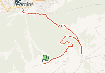
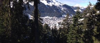
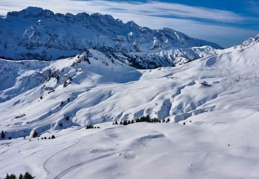
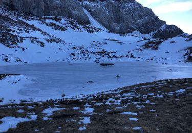
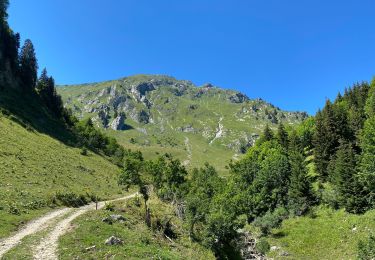
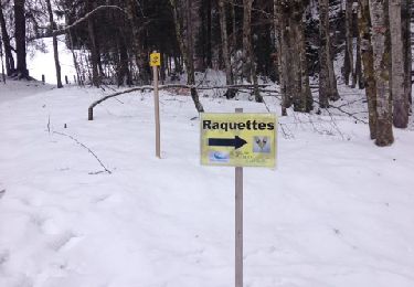
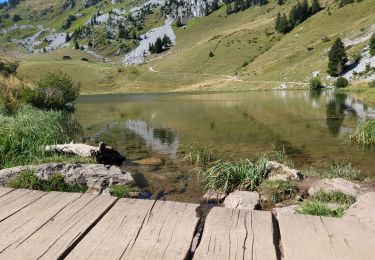
Trail Snowshoes of 5.1 km to be discovered at Valais/Wallis, Monthey, Troistorrents. This trail is proposed by boisacq.

Description

A faire dans l'autre sens car soleil et superbe apd Madzé

Elevation profile

Photos

Points of interest

Point of interest Troistorrents - Point 7 - Photo
boisacq
TROISTORRENTS 

Positioning

Country:
Switzerland
Region :
Valais/Wallis
Department/Province :
Monthey
Municipality :
Troistorrents
Location:
Unknown
Start:(UTM)
335234 ; 5121312 (32T) N.

Trails nearby

Trail On foot Val-d'Illiez - Les Crosets-Sur Cou - Photo
On foot
PRO

On foot

Easy
Val-d'Illiez, Valais/Wallis, Monthey, Switzerland
3.6 km | 4.8 km-effort
1h 6min
No
Trail Snowshoes Châtel - Randonnée entre la France et la suisse  - Photo
Snowshoes
GUIDE
pascalou73

Snowshoes

Easy
Châtel, Auvergne-Rhône-Alpes, Upper Savoy, France
5.8 km | 8.5 km-effort
2h 3min
Yes
Trail Walking Val-d'Illiez - Dents de Midi, Lac de Soi - Photo
Walking
rpf

Walking

Very easy
(1)
Val-d'Illiez, Valais/Wallis, Monthey, Switzerland
5.1 km | 9.8 km-effort
2h 30min
Yes
Trail Walking Val-d'Illiez - Lac de Soi - Photo
Walking
bozo1970

Walking

Very difficult
Val-d'Illiez, Valais/Wallis, Monthey, Switzerland
14.6 km | 30 km-effort
5h 19min
Yes
Trail Walking Châtel - Les Mattes - Photo
Walking
mlienhart

Walking

Difficult
Châtel, Auvergne-Rhône-Alpes, Upper Savoy, France
11.1 km | 22 km-effort
5h 42min
Yes
Trail Snowshoes Châtel - les Québales - Photo
Snowshoes
GUIDE
pascalou73

Snowshoes

Difficult
Châtel, Auvergne-Rhône-Alpes, Upper Savoy, France
3 km | 8.4 km-effort
2h 0min
No
Trail Walking Troistorrents - Morgins - circuit Bonavau, La Truche,La Foilleuse, Savolaire 29.09.18 - Photo
Walking
duamerg

Walking

Medium
Troistorrents, Valais/Wallis, Monthey, Switzerland
15.1 km | 23 km-effort
4h 50min
Yes
Trail Snowshoes Châtel - Châtel tennis - Chapelle d'Abond - Photo
Snowshoes
boisacq

Snowshoes

Very easy
Châtel, Auvergne-Rhône-Alpes, Upper Savoy, France
6.9 km | 10 km-effort
2h 31min
No
Trail Mountain bike Châtel - abondance  - Photo
Mountain bike
tintin73

Mountain bike

Very difficult
Châtel, Auvergne-Rhône-Alpes, Upper Savoy, France
19.8 km | 47 km-effort
4h 39min
Yes


Close
My subscriptions