


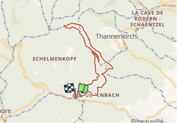

19.3 km | 24 km-effort


User


FREE GPS app for hiking
 SityTrail
IGN / Geographical institutes
SityTrail World
The world is yours!
Trail Walking of 18.5 km to be discovered at Grand Est, Haut-Rhin, Ribeauvillé. This trail is proposed by Richard68500.
Départ la Pépinière Ribeauvillé direction le Taennchel...Le Taennchel est un sommet du massif des Vosges culminant à 989 mètres. Il s'élève dans l'Est de la France, dans le département du Haut-Rhin, à mi-chemin entre Strasbourg au nord et Mulhouse au sud.
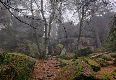
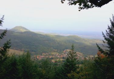
 - Photo 1")
 - Photo 2")
 - Photo 3")
 - Photo 4")

Mountain bike

Walking
Horseback riding
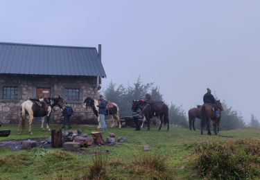
Horseback riding

Walking

Walking

Horseback riding
Mountain bike

Walking