Trail Electric bike Chorges - le tour du lac de Serre Ponçon - Photo

le tour du lac de Serre Ponçon

© OpenStreetMap contributors
Length
Length
83 km
Max alt
Max alt
1149 m
Uphill gradient
Uphill gradient
2084 m
Km-Effort
Km-Effort  
110 km
Min alt
Min alt
654 m
Downhill gradient
Downhill gradient
2103 m
Boucle
Boucle
No
Creation date :
2020-08-22 04:39:54.041
Updated on :
2020-08-24 06:48:40.5

(0 Reviews)

Electric bike
Electric bike
4h54
Difficulty : Medium

Scan this QR Code to open this trail in the SityTrail application

FREE GPS app for hiking

Logo SityTrail SityTrail

IGN / Geographical institutes

Download SityTrail from the App Store Download SityTrail from Google Play

Logo SityTrail SityTrail World

The world is yours!

Download SityTrail from the App Store Download SityTrail from Google Play Download SityTrail on Huawei AppGallery

About

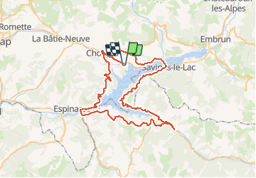
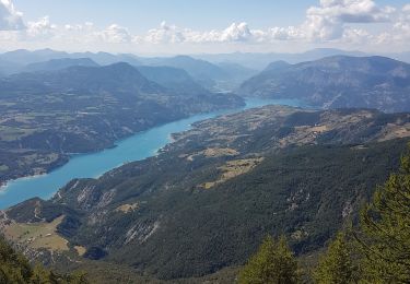
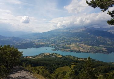
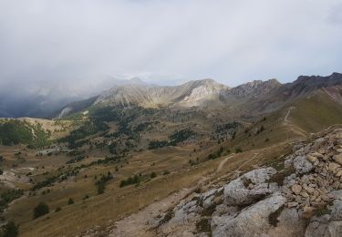
Trail Electric bike of 83 km to be discovered at Provence-Alpes-Côte d'Azur, Hautes-Alpes, Chorges. This trail is proposed by cailloux54.

Description

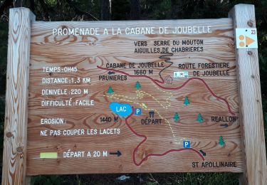
Jolie tour a faire de bonne heure le matin pour eviter la circulation automobile

Elevation profile

Photos

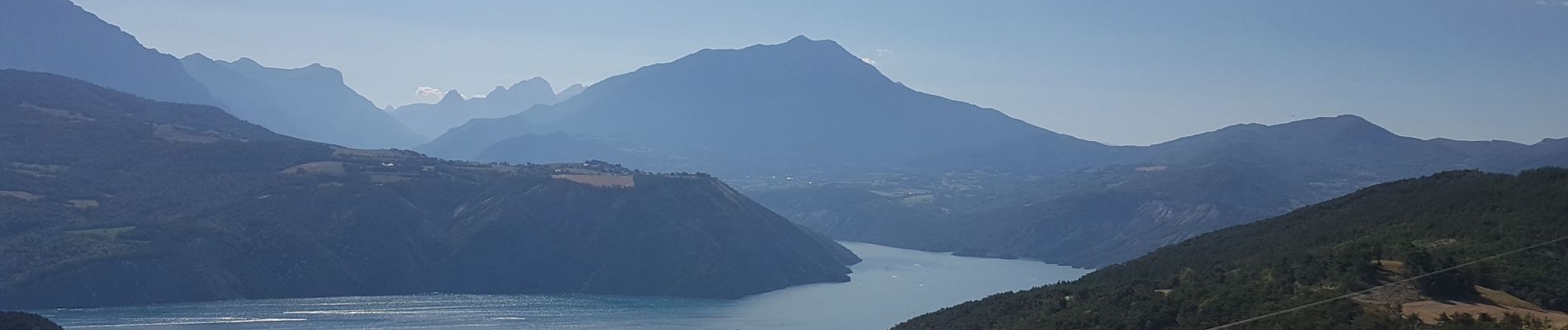
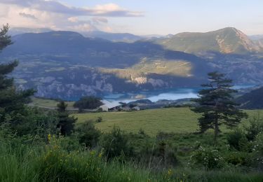
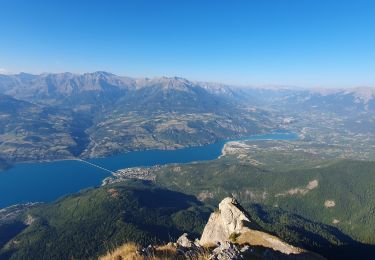
31 photos in total. Please click on a photo to see them all in the gallery.

Positioning

Country:
France
Region :
Provence-Alpes-Côte d'Azur
Department/Province :
Hautes-Alpes
Municipality :
Chorges
Location:
Unknown
Start:(UTM)
287156 ; 4933915 (32T) N.

Trails nearby

Trail Walking Chorges - Chanteloube et lac de Serre Ponçon - Photo
Walking
gildascb

Walking

Very easy
(2)
Chorges, Provence-Alpes-Côte d'Azur, Hautes-Alpes, France
5.9 km | 8.2 km-effort
1h 47min
Yes
Trail Walking Chorges - clôt c l'avais sur fein - Photo
Walking
Didier.kiehl

Walking

Very easy
(2)
Chorges, Provence-Alpes-Côte d'Azur, Hautes-Alpes, France
8 km | 12.6 km-effort
2h 24min
Yes
Trail Walking Pontis - PONTIS , le dolmen  - Photo
Walking
RobinMicheline

Walking

Medium
(1)
Pontis, Provence-Alpes-Côte d'Azur, Alpes-de-Haute-Provence, France
12.9 km | 21 km-effort
3h 50min
Yes
Trail Walking Pontis - Le Grand Morgon par la face nord 07/09/23 - Photo
Walking
GUIDE
R@ph

Walking

Difficult
Pontis, Provence-Alpes-Côte d'Azur, Alpes-de-Haute-Provence, France
7.8 km | 18.9 km-effort
4h 18min
Yes
Trail Walking Pontis - Morgon par les Traverses, retour par les Ortals - Photo
Walking
GUIDE
David25400

Walking

Very difficult
Pontis, Provence-Alpes-Côte d'Azur, Alpes-de-Haute-Provence, France
17.1 km | 33 km-effort
5h 49min
No
Trail Walking Pontis - Morgon par les Ortals - Photo
Walking
GUIDE
David25400

Walking

Difficult
Pontis, Provence-Alpes-Côte d'Azur, Alpes-de-Haute-Provence, France
15.6 km | 32 km-effort
6h 29min
Yes
Trail Walking Pontis - Pic du Morgon par Serre-Chiret - Photo
Walking
GUIDE
David25400

Walking

Difficult
Pontis, Provence-Alpes-Côte d'Azur, Alpes-de-Haute-Provence, France
14 km | 27 km-effort
4h 2min
Yes
Trail Walking Saint-Apollinaire - Aiguilles Chabrieres 08/08/18 - Photo
Walking
GUIDE
R@ph

Walking

Medium
Saint-Apollinaire, Provence-Alpes-Côte d'Azur, Hautes-Alpes, France
11 km | 24 km-effort
4h 42min
Yes
Trail Walking Saint-Apollinaire - Aiguilles de Chabrières - Photo
Walking
DaumasChris

Walking

Medium
(1)
Saint-Apollinaire, Provence-Alpes-Côte d'Azur, Hautes-Alpes, France
13.1 km | 26 km-effort
4h 47min
Yes


Close
My subscriptions