Trail Walking Juliénas - Juliénas (69) 10 km - D. 284 m - Photo

Juliénas (69) 10 km - D. 284 m

© OpenStreetMap contributors
Length
Length
10.4 km
Max alt
Max alt
474 m
Uphill gradient
Uphill gradient
284 m
Km-Effort
Km-Effort  
14.2 km
Min alt
Min alt
247 m
Downhill gradient
Downhill gradient
278 m
Boucle
Boucle
Yes
Creation date :
2021-03-14 09:12:32.0
Updated on :
2021-03-16 09:33:53.342

(0 Reviews)

Walking
Walking
4h18
Difficulty : Easy

Scan this QR Code to open this trail in the SityTrail application

FREE GPS app for hiking

Logo SityTrail SityTrail

IGN / Geographical institutes

Download SityTrail from the App Store Download SityTrail from Google Play

Logo SityTrail SityTrail World

The world is yours!

Download SityTrail from the App Store Download SityTrail from Google Play Download SityTrail on Huawei AppGallery

About

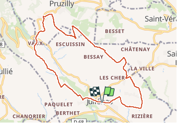
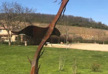
Trail Walking of 10.4 km to be discovered at Auvergne-Rhône-Alpes, Rhône, Juliénas. This trail is proposed by Thomasdanielle.

Description

Parking sur la route devant la salle polyvalente
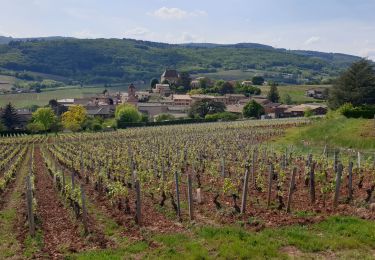
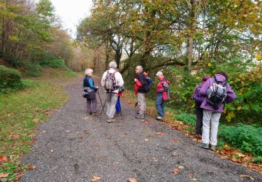
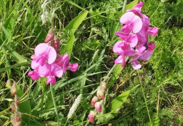
Elevation profile

Photos

Positioning

Country:
France
Region :
Auvergne-Rhône-Alpes
Department/Province :
Rhône
Municipality :
Juliénas
Location:
Unknown
Start:(UTM)
632035 ; 5121532 (31T) N.

Trails nearby

Trail Walking Vauxrenard - Itinérant Beaujolais rouge étape 6 Foretal - Macon gare TGV - Photo
Walking
chessyca

Walking

Very difficult
Vauxrenard, Auvergne-Rhône-Alpes, Rhône, France
23 km | 28 km-effort
6h 26min
No
Trail Walking Leynes - LEYNES 71 - Photo
Walking
janussity

Walking

Difficult
Leynes, Bourgogne-Franche-Comté, Saône-et-Loire, France
9.5 km | 12.7 km-effort
2h 38min
Yes
Trail Walking Saint-Vérand - St Vérand - Photo
Walking
JPA GRS

Walking

Medium
(1)
Saint-Vérand, Bourgogne-Franche-Comté, Saône-et-Loire, France
9.8 km | 12.6 km-effort
2h 0min
Yes
Trail Walking Fleurie - Fleurie (Rhône) 17 km - D. 498 m - Photo
Walking
Thomasdanielle

Walking

Medium
Fleurie, Auvergne-Rhône-Alpes, Rhône, France
16.7 km | 23 km-effort
5h 25min
Yes
Trail Walking Vinzelles - Vinzelles - Photo
Walking
janussity

Walking

Easy
(1)
Vinzelles, Bourgogne-Franche-Comté, Saône-et-Loire, France
7.8 km | 10.1 km-effort
2h 6min
Yes
Trail Walking Cenves - cenves la madone  - Photo
Walking
darrisa

Walking

Very difficult
Cenves, Auvergne-Rhône-Alpes, Rhône, France
16.6 km | 26 km-effort
6h 0min
Yes
Trail Walking Cenves - Séjour RCY Les crêtes du Haut Beaujolais journée 2 - Photo
Walking
chessyca

Walking

Very difficult
Cenves, Auvergne-Rhône-Alpes, Rhône, France
27 km | 40 km-effort
6h 53min
No
Trail Walking Chaintré - Chantré  (Saône et Loire) - Photo
Walking
Thomasdanielle

Walking

Medium
Chaintré, Bourgogne-Franche-Comté, Saône-et-Loire, France
13.8 km | 18.5 km-effort
5h 37min
Yes
Trail Walking Chasselas - Chasselas (Saône- et-Loire région Bourgogne)   - Photo
Walking
Thomasdanielle

Walking

Difficult
Chasselas, Bourgogne-Franche-Comté, Saône-et-Loire, France
15.1 km | 23 km-effort
5h 34min
Yes


Close
My subscriptions