


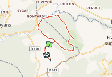

5 km | 6.7 km-effort


User


FREE GPS app for hiking
 SityTrail
IGN / Geographical institutes
SityTrail World
The world is yours!
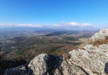
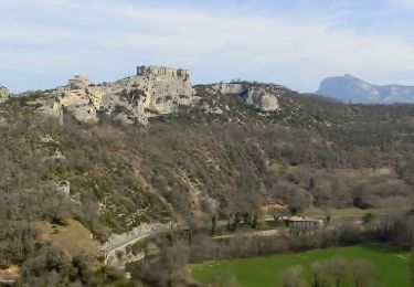
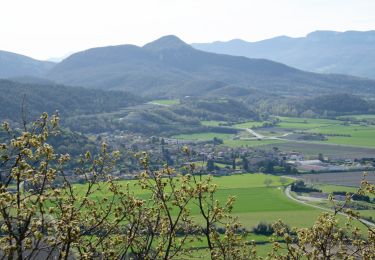
Trail Walking of 7.9 km to be discovered at Auvergne-Rhône-Alpes, Drôme, Soyans. This trail is proposed by johnw.
gevarieerde rondwandeling, ongeveer 2 uur.
zit een wat pittige afdaling in maar goed te doen met normale wandelschoenen.

Walking

Walking
Walking

Walking
Walking
Walking
Walking
Walking
Walking