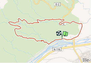
11 km | 15.3 km-effort
20210720 Ille sur Tet
Childebert
User
Length
6.3 km
Max alt
294 m
Uphill gradient
159 m
Km-Effort
8.4 km
Min alt
139 m
Downhill gradient
159 m
Boucle
Yes
Creation date :
2021-07-20 09:41:01.025
Updated on :
2021-07-20 19:11:08.289
4h04
Difficulty : Very difficult
FREE GPS app for hiking
About
Trail Walking of 6.3 km to be discovered at Occitania, Pyrénées-Orientales, Ille-sur-Têt. This trail is proposed by Childebert.
Positioning
Country:
France
Region :
Occitania
Department/Province :
Pyrénées-Orientales
Municipality :
Ille-sur-Têt
Location:
Unknown
Start:(Dec)
Start:(UTM)
468182 ; 4724924 (31T) N.
Comments
Trails nearby
ILLE TÊT 66 - PIC PEDROUS - CASESNOVES
Walking
Medium
(10)
Ille-sur-Têt,
Occitania,
Pyrénées-Orientales,
France
2h 22min
Yes
Boucle du Pic Aubeill
Walking
Easy
(1)
Bélesta,
Occitania,
Pyrénées-Orientales,
France
8 km | 10.9 km-effort
2h 24min
Yes
Montauban le château corral grandes or
Walking
Difficult
Montalba-le-Château,
Occitania,
Pyrénées-Orientales,
France
12.9 km | 16.3 km-effort
3h 42min
Yes
montant a
Walking
Difficult
Montalba-le-Château,
Occitania,
Pyrénées-Orientales,
France
11.8 km | 14.7 km-effort
5h 2min
No
20221222 Rodés - Domanova…. Boucle
Walking
Medium
Rodès,
Occitania,
Pyrénées-Orientales,
France
21 km | 33 km-effort
5h 49min
Yes
Ille st jules
Walking
Difficult
Ille-sur-Têt,
Occitania,
Pyrénées-Orientales,
France
11.2 km | 12.7 km-effort
3h 2min
Yes
Gorges de la Guillera
Walking
Easy
Rodès,
Occitania,
Pyrénées-Orientales,
France
3.2 km | 4.9 km-effort
1h 37min
Yes
20220217 au départ de Rodes
Walking
Medium
Rodès,
Occitania,
Pyrénées-Orientales,
France
15.2 km | 26 km-effort
4h 56min
Yes
Bouleternere
Walking
Medium
Bouleternère,
Occitania,
Pyrénées-Orientales,
France
13.9 km | 20 km-effort
3h 52min
Yes
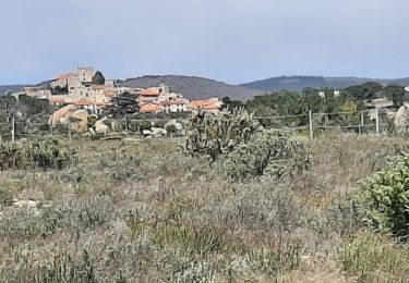
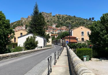
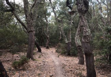
randonnée avec un dénivelé important au début (150m environ) sur de la roche, ensuite relativement plat sur une route engravillonée. sur la descente ensuite, chemin pas du tout entretenu et donc compliqué. par contre, on a mis 2h30 et pas 4h