


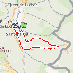

7.1 km | 12.5 km-effort

User


FREE GPS app for hiking
 SityTrail
IGN / Geographical institutes
SityTrail World
The world is yours!
Trail Walking of 15.6 km to be discovered at Occitania, Haute-Garonne, Saint-Mamet. This trail is proposed by tracegps.
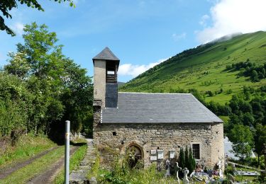
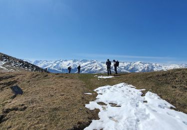
Départ du cimetière de Saint Mamet, rue Pierre Baysse. Attaquer le chemin par la gauche et ensuite monter vers la droite. La difficulté de ce circuit est la première ascension, du KM 1.500 au KM 4.900 le dénivelé positif est de 800m. De préférence il faut faire ce parcours à l'automne (septembre, début Octobre si la météo est belle) pour profiter de la pleine végétation. On quitte la forêt au KM 8.470 pour rattraper la D618A. On reprend un sentier de randonnée au KM 11.900 qui nous ramène aux portes de Saint-Mamet sur la D618A (KM 13.100).


Snowshoes

Mountain bike

Walking

Walking

Walking
Walking
On foot
On foot
Walking
application découverte par hasard et parfaite pour les randos pédestres et pour les vététistes. On trouve de quoi se restaurer, dormir et également ce qui concerne la santé comme cabinets dentaires ou médicaux......en rando tout peut arriver.