Trail Snowshoes Juzet-de-Luchon - JUZET - PAS DE LA COMBE (LABACH) - Photo

JUZET - PAS DE LA COMBE (LABACH)

© OpenStreetMap contributors
Length
Length
7.1 km
Max alt
Max alt
1044 m
Uphill gradient
Uphill gradient
406 m
Km-Effort
Km-Effort  
12.5 km
Min alt
Min alt
640 m
Downhill gradient
Downhill gradient
405 m
Boucle
Boucle
Yes
Creation date :
2017-01-25 00:00:00.0
Updated on :
2017-01-25 00:00:00.0

(1 Reviews)

Snowshoes
Snowshoes
2h33
Difficulty : Medium

Scan this QR Code to open this trail in the SityTrail application

FREE GPS app for hiking

Logo SityTrail SityTrail

IGN / Geographical institutes

Download SityTrail from the App Store Download SityTrail from Google Play

Logo SityTrail SityTrail World

The world is yours!

Download SityTrail from the App Store Download SityTrail from Google Play Download SityTrail on Huawei AppGallery

About

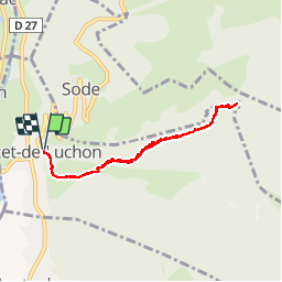
Trail Snowshoes of 7.1 km to be discovered at Occitania, Haute-Garonne, Juzet-de-Luchon. This trail is proposed by Marcocroco.

Description

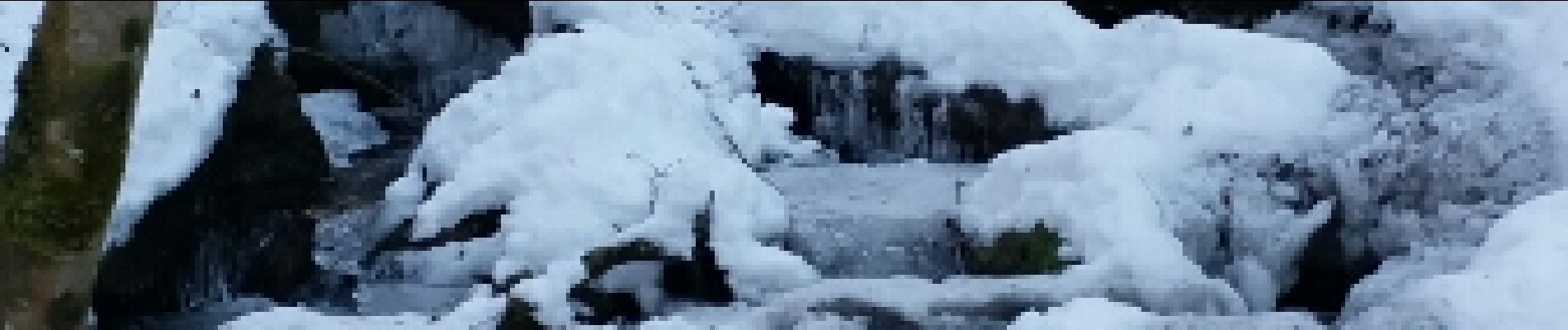
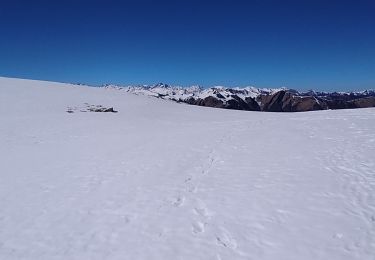
raquettes neige dure et grosse épaisseur dans le fond de la combe

Elevation profile

Photos

Positioning

Country:
France
Region :
Occitania
Department/Province :
Haute-Garonne
Municipality :
Juzet-de-Luchon
Location:
Unknown
Start:(UTM)
304576 ; 4742298 (31T) N.

Comments

Please log in to post a review or rate the element


le nom n'est pas Pas de la Combe mais Pas de Bourgs


Trails nearby

Trail Walking Saint-Mamet - Fonds de Burbe - Saint Mamet - Photo
Walking
tracegps

Walking

Difficult
(1)
Saint-Mamet, Occitania, Haute-Garonne, France
15.6 km | 27 km-effort
4h 0min
Yes
Trail Mountain bike Saint-Aventin - Luchon Kbour - Photo
Mountain bike
tracegps

Mountain bike

Very difficult
(1)
Saint-Aventin, Occitania, Haute-Garonne, France
11 km | 16.7 km-effort
1h 0min
No
Trail Walking Saccourvielle - Cap de Salières en boucle depuis Saccourvielle - Photo
Walking
GUIDE
lhomme.ph

Walking

Medium
Saccourvielle, Occitania, Haute-Garonne, France
12.1 km | 24 km-effort
6h 23min
Yes
Trail Walking Bagnères-de-Luchon - GR 10 - 3 - Photo
Walking
loic09

Walking

Medium
(2)
Bagnères-de-Luchon, Occitania, Haute-Garonne, France
250 km | 489 km-effort
89h 8min
No
Trail Walking Artigue - ARTIGUE - Gouaux de Luchon - chemin forestier - Photo
Walking
josy31

Walking

Medium
(1)
Artigue, Occitania, Haute-Garonne, France
13.7 km | 23 km-effort
3h 21min
Yes
Trail Walking Artigue - Artigue par la cabane du plan Bosc et la cabane de Saunères - Photo
Walking
swp648

Walking

Difficult
Artigue, Occitania, Haute-Garonne, France
10.5 km | 18.3 km-effort
4h 10min
Yes
Trail Walking Bagnères-de-Luchon - 2022 08 -Transpyrénéen 2 : Bagnères de Luchon -Fos - Photo
Walking
LEGUE

Walking

Very difficult
Bagnères-de-Luchon, Occitania, Haute-Garonne, France
30 km | 55 km-effort
7h 8min
No
Trail Walking Artigue - 2022-02-26 Artigue - cabane de peyrehitte - mont Majou -  luchonais - Photo
Walking
jacq58

Walking

Difficult
Artigue, Occitania, Haute-Garonne, France
12 km | 22 km-effort
3h 33min
Yes
Trail On foot Saint-Aventin - La Forestière - Photo
On foot
PRO

On foot

Easy
Saint-Aventin, Occitania, Haute-Garonne, France
7.3 km | 11.7 km-effort
2h 39min
No


Close
My subscriptions