Trail Walking Vallouise-Pelvoux - lac de l'Eychauda col des Grangettes pas de l'âne et col de l'Eychauda - Photo

lac de l'Eychauda col des Grangettes pas de l'âne et col de l'Eychauda

 amiral13
amiral13

User GUIDE

© OpenStreetMap contributors
Length
Length
15.8 km
Max alt
Max alt
2667 m
Uphill gradient
Uphill gradient
1168 m
Km-Effort
Km-Effort  
31 km
Min alt
Min alt
1717 m
Downhill gradient
Downhill gradient
1170 m
Boucle
Boucle
Yes
Creation date :
2022-07-12 05:46:57.26
Updated on :
2022-07-29 10:09:08.461

(0 Reviews)

Walking
Walking
7h46
Difficulty : Difficult

Scan this QR Code to open this trail in the SityTrail application

FREE GPS app for hiking

Logo SityTrail SityTrail

IGN / Geographical institutes

Download SityTrail from the App Store Download SityTrail from Google Play

Logo SityTrail SityTrail World

The world is yours!

Download SityTrail from the App Store Download SityTrail from Google Play Download SityTrail on Huawei AppGallery

About

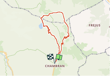
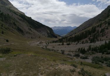
Trail Walking of 15.8 km to be discovered at Provence-Alpes-Côte d'Azur, Hautes-Alpes, Vallouise-Pelvoux. This trail is proposed by amiral13.

Description

rando effectuée le 12 juillet 2022
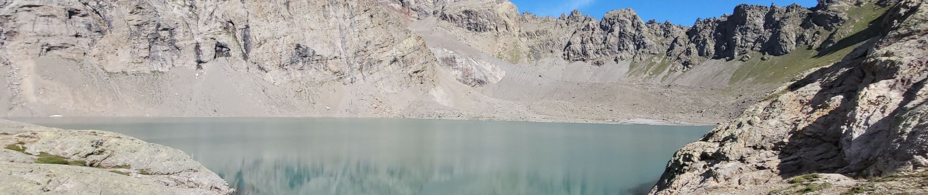
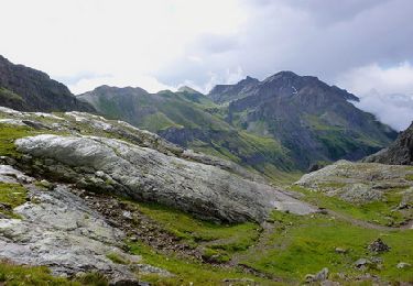
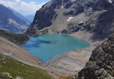
jusqu'au lac de l'Eychauda il s'agit d'une randonnée pour tous. L'accès au col des Grangettes est à peine plus compliqué mais sur la fin le sentier est un peu plus délicat.
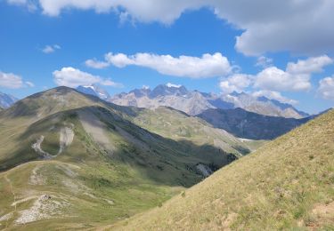
Quant à la descente du col des Grangettes côté nord elle est à réserver aux randonneurs aguerris; en effet, bien que récemment équipée de câble, elle présente un danger de chute sans compter les chutes de pierre; la suite du sentier est glissante . le franchissement du pas de l'ane te du col de Eychauda ne posent pas de problème. la descente du col se fait sur un agréable sentier.

Elevation profile

Photos

Positioning

Country:
France
Region :
Provence-Alpes-Côte d'Azur
Department/Province :
Hautes-Alpes
Municipality :
Vallouise-Pelvoux
Location:
Pelvoux
Start:(UTM)
302076 ; 4975058 (32T) N.

Trails nearby

Trail Walking Vallouise-Pelvoux - 2020-09-09 Marche Lac de L'Eychauda - Photo
Walking
GUIDE
holtzv

Walking

Easy
(1)
Vallouise-Pelvoux, Provence-Alpes-Côte d'Azur, Hautes-Alpes, France
14.5 km | 28 km-effort
6h 2min
Yes
Trail Walking Vallouise-Pelvoux - traversé du pelvoux - Photo
Walking
bellouelo46

Walking

Very easy
(2)
Vallouise-Pelvoux, Provence-Alpes-Côte d'Azur, Hautes-Alpes, France
25 km | 58 km-effort
19h 10min
No
Trail Walking Saint-Chaffrey - le Prorel au départ de la Serre Chevalier - Photo
Walking
GUIDE
amiral13

Walking

Easy
Saint-Chaffrey, Provence-Alpes-Côte d'Azur, Hautes-Alpes, France
7.9 km | 13.8 km-effort
3h 41min
Yes
Trail On foot Vallouise-Pelvoux - Boucle vers Puy Aillaud - Photo
On foot
PRO

On foot

Easy
Vallouise-Pelvoux, Provence-Alpes-Côte d'Azur, Hautes-Alpes, France
5.3 km | 10.2 km-effort
2h 19min
No
Trail Walking Vallouise-Pelvoux - Lac Eychauda - Photo
Walking
MarcLEBARON

Walking

Medium
(1)
Vallouise-Pelvoux, Provence-Alpes-Côte d'Azur, Hautes-Alpes, France
8.4 km | 18.6 km-effort
3h 10min
Yes
Trail Walking Vallouise-Pelvoux - Lac de l'Eychauda en boucle - Photo
Walking
GuyVachet

Walking

Very difficult
Vallouise-Pelvoux, Provence-Alpes-Côte d'Azur, Hautes-Alpes, France
15.8 km | 31 km-effort
5h 47min
Yes
Trail Walking Vallouise-Pelvoux - Lac Eychauda et le  col des Grangettes - Photo
Walking
Forain

Walking

Medium
Vallouise-Pelvoux, Provence-Alpes-Côte d'Azur, Hautes-Alpes, France
13.2 km | 26 km-effort
3h 20min
Yes
Trail Walking Vallouise-Pelvoux - Source Puiseux - Photo
Walking
Sigmut

Walking

Medium
Vallouise-Pelvoux, Provence-Alpes-Côte d'Azur, Hautes-Alpes, France
9 km | 15.3 km-effort
4h 17min
Yes
Trail Walking Vallouise-Pelvoux - Cabane pastorale de l'Eychauda - Photo
Walking
Sigmut

Walking

Very easy
Vallouise-Pelvoux, Provence-Alpes-Côte d'Azur, Hautes-Alpes, France
3.7 km | 5 km-effort
1h 42min
Yes


Close
My subscriptions