Trail Road bike Jausiers - Jausiers - Beuil V2 - Photo
 bosses21
bosses21

User

© OpenStreetMap contributors
Length
Length
90 km
Max alt
Max alt
2331 m
Uphill gradient
Uphill gradient
2650 m
Km-Effort
Km-Effort  
125 km
Min alt
Min alt
787 m
Downhill gradient
Downhill gradient
2426 m
Boucle
Boucle
No
Creation date :
2022-07-18 10:36:34.204
Updated on :
2022-07-23 13:39:01.681

(0 Reviews)

Road bike
Road bike
7h33
Difficulty : Very difficult

Scan this QR Code to open this trail in the SityTrail application

FREE GPS app for hiking

Logo SityTrail SityTrail

IGN / Geographical institutes

Download SityTrail from the App Store Download SityTrail from Google Play

Logo SityTrail SityTrail World

The world is yours!

Download SityTrail from the App Store Download SityTrail from Google Play Download SityTrail on Huawei AppGallery

About

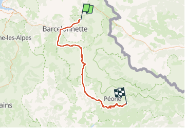
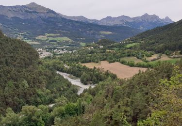
Trail Road bike of 90 km to be discovered at Provence-Alpes-Côte d'Azur, Alpes-de-Haute-Provence, Jausiers. This trail is proposed by bosses21.
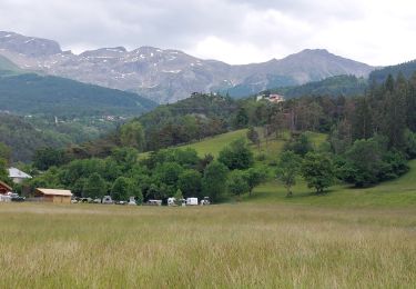
Description

Les cols du jour
- Col de la Cayolle, 2326 m.
- Col de Valberg, 1650 m.
Les moments forts
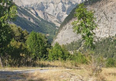
- La bascule de la vallée de l’Ubaye à la haute vallée du Verdon par la très ancienne route du col d’Allos
- Col de la Cayolle : une superbe ascension en plein coeur du Parc National du Mercantour.
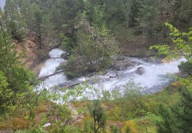
- Les gorges du Bachelard

Elevation profile

Points of interest

Point of interest Guillaumes - Col de Valberg - 1662 m - Photo
bosses21
Point of interest Beuil - Hôtel Genepi - Photo
bosses21

Positioning

Country:
France
Region :
Provence-Alpes-Côte d'Azur
Department/Province :
Alpes-de-Haute-Provence
Municipality :
Jausiers
Location:
Unknown
Start:(UTM)
319823 ; 4921081 (32T) N.

Trails nearby

Trail Walking Faucon-de-Barcelonnette - Pre de RATA et St Flavie - Photo
Walking
andre06130

Walking

Difficult
(1)
Faucon-de-Barcelonnette, Provence-Alpes-Côte d'Azur, Alpes-de-Haute-Provence, France
7.8 km | 13.4 km-effort
3h 7min
Yes
Trail Mountain bike Jausiers - Espace VTT FFC Vallée de l'Ubaye - Circuit n° 01 - La Tour des Sagnes - Photo
Mountain bike
tracegps

Mountain bike

Very difficult
(1)
Jausiers, Provence-Alpes-Côte d'Azur, Alpes-de-Haute-Provence, France
31 km | 45 km-effort
4h 0min
Yes
Trail Walking Jausiers - Fontaine de la pissoun 15-08-12 - Photo
Walking
darktotor51

Walking

Medium
(1)
Jausiers, Provence-Alpes-Côte d'Azur, Alpes-de-Haute-Provence, France
9.5 km | 16.5 km-effort
3h 16min
Yes
Trail Electric bike Jausiers - Flavi Barcelonnette  - Photo
Electric bike
Yves Locati

Electric bike

Medium
Jausiers, Provence-Alpes-Côte d'Azur, Alpes-de-Haute-Provence, France
14.1 km | 21 km-effort
1h 47min
No
Trail Walking Jausiers - cascadede pissoun 24 06 2024 - Photo
Walking
GUIDE
japy54

Walking

Medium
Jausiers, Provence-Alpes-Côte d'Azur, Alpes-de-Haute-Provence, France
7.2 km | 13.1 km-effort
2h 21min
Yes
Trail Walking Jausiers - Pas de Grégoire /Chatelard - Photo
Walking
andre06130

Walking

Medium
Jausiers, Provence-Alpes-Côte d'Azur, Alpes-de-Haute-Provence, France
6.9 km | 11.3 km-effort
2h 1min
Yes
Trail Walking Enchastrayes - PETIT TOUR A BARCELONNETTE - Photo
Walking
walrou63

Walking

Medium
Enchastrayes, Provence-Alpes-Côte d'Azur, Alpes-de-Haute-Provence, France
7.3 km | 8.8 km-effort
2h 20min
Yes
Trail Walking Enchastrayes - Aupillon-cabane basse 04 - Photo
Walking
janussity

Walking

Difficult
Enchastrayes, Provence-Alpes-Côte d'Azur, Alpes-de-Haute-Provence, France
11.1 km | 18 km-effort
3h 24min
Yes
Trail Walking Jausiers - Petite ballade autour du pas de Grégoire  - Photo
Walking
andre06130

Walking

Medium
Jausiers, Provence-Alpes-Côte d'Azur, Alpes-de-Haute-Provence, France
4.7 km | 7.9 km-effort
1h 17min
Yes


Close
My subscriptions