


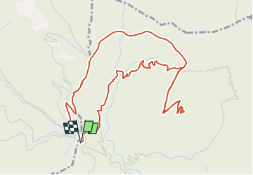

8.1 km | 14.4 km-effort


User


FREE GPS app for hiking
 SityTrail
IGN / Geographical institutes
SityTrail World
The world is yours!
Trail Walking of 6.5 km to be discovered at Provence-Alpes-Côte d'Azur, Maritime Alps, Sainte-Agnès. This trail is proposed by eaea7charles.
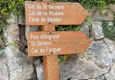
de Sainte Agnès, prendre la direction de Peyre grosse et le col des banquettes. Se stationner au col des banquettes, si possible.

Walking
On foot

Walking
Walking
Walking

Walking
Walking
Walking
Walking