Trail Walking Brestot - Balade de la Vierge de Brumare - Photo

Balade de la Vierge de Brumare

© OpenStreetMap contributors
Length
Length
5.9 km
Max alt
Max alt
137 m
Uphill gradient
Uphill gradient
99 m
Km-Effort
Km-Effort  
7.2 km
Min alt
Min alt
51 m
Downhill gradient
Downhill gradient
97 m
Boucle
Boucle
Yes
Creation date :
2015-10-06 00:00:00.0
Updated on :
2015-10-06 00:00:00.0

(0 Reviews)

Walking
Walking
1h30
Difficulty : Easy

Scan this QR Code to open this trail in the SityTrail application

FREE GPS app for hiking

Logo SityTrail SityTrail

IGN / Geographical institutes

Download SityTrail from the App Store Download SityTrail from Google Play

Logo SityTrail SityTrail World

The world is yours!

Download SityTrail from the App Store Download SityTrail from Google Play Download SityTrail on Huawei AppGallery

About

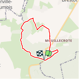
Trail Walking of 5.9 km to be discovered at Normandy, Eure, Brestot. This trail is proposed by dominiquelouis.

Description

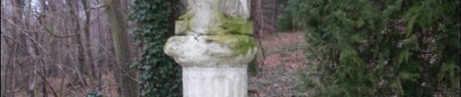
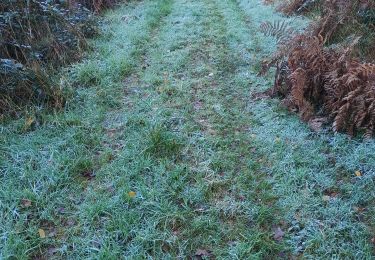
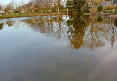
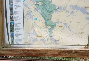
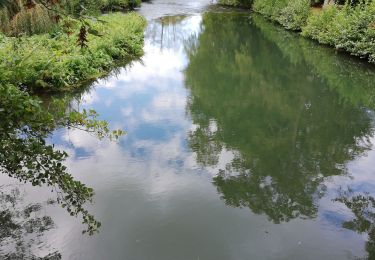
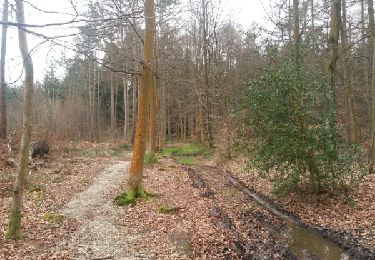
Au départ de l'aire d'accueil du Val Dallet: balade pédestre de 6 km en forêt domaniale de Montfort et dans le vallon du Val Dallet, en passant par le château et la Vierge de Brumare

Elevation profile

Photos

Positioning

Country:
France
Region :
Normandy
Department/Province :
Eure
Municipality :
Brestot
Location:
Unknown
Start:(UTM)
330822 ; 5466756 (31U) N.

Trails nearby

Trail Walking Illeville-sur-Montfort - Illeville sur Montfort - Le circuit des Jacinthes - La Ferme de Fourges - Photo
Walking
MichelRando7656

Walking

Difficult
Illeville-sur-Montfort, Normandy, Eure, France
12.3 km | 14.4 km-effort
3h 13min
Yes
Trail Walking Illeville-sur-Montfort - Illeville-sur-Monfort - Le circuit des Jacinthes - Photo
Walking
MichelRando7656

Walking

Difficult
(2)
Illeville-sur-Montfort, Normandy, Eure, France
12.3 km | 14.5 km-effort
3h 8min
Yes
Trail Walking Condé-sur-Risle - Circuit des faneuses -Condé sur Risle-St Christophe sur Condé  - Photo
Walking
MichelRando7656

Walking

Difficult
Condé-sur-Risle, Normandy, Eure, France
14 km | 16.4 km-effort
4h 8min
Yes
Trail Walking Colletot - Colletot à Corneille sur Risle - Photo
Walking
MichelRando7656

Walking

Difficult
(1)
Colletot, Normandy, Eure, France
11.3 km | 13.4 km-effort
2h 50min
Yes
Trail Walking Cauverville-en-Roumois - Cauverville en Roumois - Le chemin du chênede la Vierge - Photo
Walking
MichelRando7656

Walking

Difficult
(1)
Cauverville-en-Roumois, Normandy, Eure, France
11.7 km | 13.9 km-effort
3h 6min
Yes
Trail Walking Appeville-Annebault - Appeville Annebault - Photo
Walking
Roulland

Walking

Medium
(1)
Appeville-Annebault, Normandy, Eure, France
26 km | 33 km-effort
4h 42min
Yes
Trail Walking Montfort-sur-Risle - Montfort-sur-Risle  - Photo
Walking
MichelRando7656

Walking

Difficult
Montfort-sur-Risle, Normandy, Eure, France
21 km | 26 km-effort
7h 21min
Yes
Trail Walking Appeville-Annebault - appeville - Photo
Walking
MichelRando7656

Walking

Medium
Appeville-Annebault, Normandy, Eure, France
23 km | 29 km-effort
5h 6min
Yes
Trail Walking Illeville-sur-Montfort - chemin des Séquoias - Photo
Walking
dominiquelouis

Walking

Medium
Illeville-sur-Montfort, Normandy, Eure, France
7.8 km | 9.7 km-effort
2h 56min
Yes


Close
My subscriptions