Trail Walking Saint-Christophe - la voie SARDE / tunnel des l'Echelles /st Christophe sur Guiers - Photo

la voie SARDE / tunnel des l'Echelles /st Christophe sur Guiers

 okfred26
okfred26

User

© OpenStreetMap contributors
Length
Length
15.1 km
Max alt
Max alt
679 m
Uphill gradient
Uphill gradient
590 m
Km-Effort
Km-Effort  
23 km
Min alt
Min alt
399 m
Downhill gradient
Downhill gradient
581 m
Boucle
Boucle
Yes
Creation date :
2023-06-29 07:05:58.963
Updated on :
2023-06-30 07:22:05.071

(0 Reviews)

Walking
Walking
5h12
Difficulty : Very difficult

Scan this QR Code to open this trail in the SityTrail application

FREE GPS app for hiking

Logo SityTrail SityTrail

IGN / Geographical institutes

Download SityTrail from the App Store Download SityTrail from Google Play

Logo SityTrail SityTrail World

The world is yours!

Download SityTrail from the App Store Download SityTrail from Google Play Download SityTrail on Huawei AppGallery

About

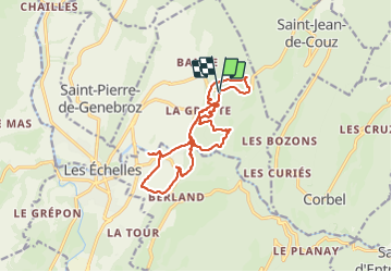
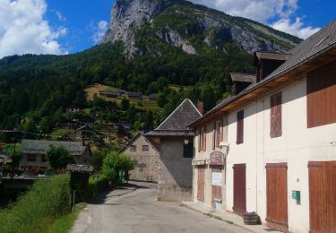
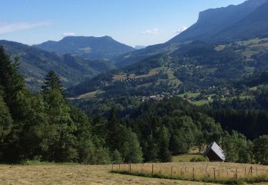
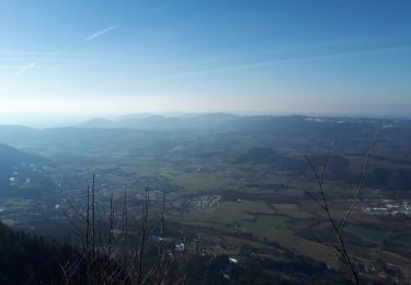
Trail Walking of 15.1 km to be discovered at Auvergne-Rhône-Alpes, Savoy, Saint-Christophe. This trail is proposed by okfred26.

Description

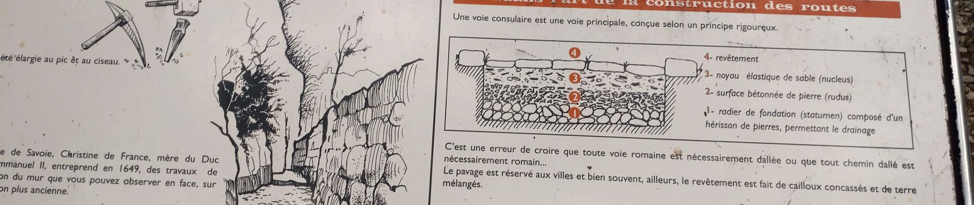
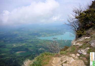
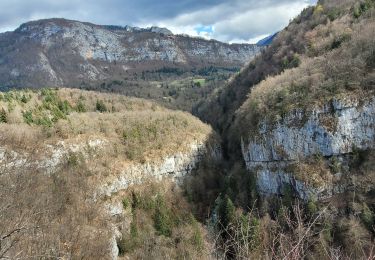
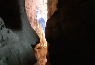
Certains secteurs avec aménagements de câbles ,marches acier scellées et  d' escaliers.

IBP= 59

(Qu'apporte l'indice IBP?

L'indice IBP est un système d'évaluation automatique de la difficulté d'un itinéraire parcouru en vélo tout terrain, en vélo de route, en randonnée pédestre ou en course.

Cet indice est très utile pour connaître la difficulté de différents itinéraires et afin de pouvoir les comparer.

Il est important de ne pas confondre le degré de difficulté d'un itinéraire avec l'effort physique déployé pour le réaliser : un indice IBP de 60 sera un parcours très difficile pour une personne non entrainée, normal avec une préparation physique moyenneet très facile pour un professionnel. )

Elevation profile

Photos

Positioning

Country:
France
Region :
Auvergne-Rhône-Alpes
Department/Province :
Savoy
Municipality :
Saint-Christophe
Location:
Unknown
Start:(UTM)
718291 ; 5037070 (31T) N.

Trails nearby

Trail Snowshoes Saint-Christophe-sur-Guiers - Le Belvédère d'Arpison - Photo
Snowshoes
patjobou

Snowshoes

Medium
(1)
Saint-Christophe-sur-Guiers, Auvergne-Rhône-Alpes, Isère, France
11.1 km | 17.4 km-effort
4h 43min
Yes
Trail Walking Attignat-Oncin - Le Mont Grelle 1425m, depuis Attignat - Oncin - Photo
Walking
tracegps

Walking

Medium
(3)
Attignat-Oncin, Auvergne-Rhône-Alpes, Savoy, France
9.6 km | 17.6 km-effort
4h 30min
Yes
Trail Walking Saint-Pierre-d'Entremont - Roche Veyrand par les Clapiers, 1429m - Photo
Walking
tracegps

Walking

Difficult
(1)
Saint-Pierre-d'Entremont, Auvergne-Rhône-Alpes, Savoy, France
4.8 km | 14.3 km-effort
4h 10min
Yes
Trail Walking Saint-Christophe - 190323 Boucle voie Sarde - Photo
Walking
mzonzon05

Walking

Difficult
Saint-Christophe, Auvergne-Rhône-Alpes, Savoy, France
9.7 km | 15.6 km-effort
3h 50min
Yes
Trail Walking Saint-Christophe - Grottes des Echelles - Photo
Walking
cousam

Walking

Medium
Saint-Christophe, Auvergne-Rhône-Alpes, Savoy, France
7.4 km | 12.1 km-effort
3h 16min
Yes
Trail Walking La Bauche - Ballade vers la Bauche - Photo
Walking
nadd73

Walking

Easy
La Bauche, Auvergne-Rhône-Alpes, Savoy, France
11.7 km | 23 km-effort
6h 19min
Yes
Trail Walking Saint-Pierre-d'Entremont - Saint Pierre d'Entremont (Isère) Cirque de Saint Même  - Photo
Walking
zazie

Walking

Medium
Saint-Pierre-d'Entremont, Auvergne-Rhône-Alpes, Isère, France
11.4 km | 18.7 km-effort
2h 44min
Yes
Trail Walking Saint-Pierre-d'Entremont - Étape 20 variante St Pierre d’Entremont - St Pierre de Chartreuse  - Photo
Walking
pcugnod

Walking

Medium
Saint-Pierre-d'Entremont, Auvergne-Rhône-Alpes, Isère, France
14.6 km | 0 m-effort
5h 5min
No
Trail Walking Saint-Christophe-sur-Guiers - La Ruchere - Col de l'Allienard - Photo
Walking
bruno.saget

Walking

Medium
Saint-Christophe-sur-Guiers, Auvergne-Rhône-Alpes, Isère, France
11.9 km | 18.7 km-effort
4h 34min
Yes


Close
My subscriptions