Trail Walking Estagel - ESTAGEL Chapelle St Laurent MARDI FAIT - Photo

ESTAGEL Chapelle St Laurent MARDI FAIT

© OpenStreetMap contributors
Length
Length
12.2 km
Max alt
Max alt
241 m
Uphill gradient
Uphill gradient
353 m
Km-Effort
Km-Effort  
16.9 km
Min alt
Min alt
75 m
Downhill gradient
Downhill gradient
353 m
Boucle
Boucle
Yes
Creation date :
2024-04-21 08:14:48.459
Updated on :
2024-04-22 09:29:40.472

(0 Reviews)

Walking
Walking
3h26
Difficulty : Medium

Scan this QR Code to open this trail in the SityTrail application

FREE GPS app for hiking

Logo SityTrail SityTrail

IGN / Geographical institutes

Download SityTrail from the App Store Download SityTrail from Google Play

Logo SityTrail SityTrail World

The world is yours!

Download SityTrail from the App Store Download SityTrail from Google Play Download SityTrail on Huawei AppGallery

About

Trail Walking of 12.2 km to be discovered at Occitania, Pyrénées-Orientales, Estagel. This trail is proposed by MarcOBRECHT.

Description

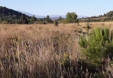
Départ parking place De Gaulle, tilleuls.
Partir par église puis rue Sauvy, bd Victor Hugo, Michelet, route de Montner.
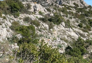
El Linas, montée sur colline avec vue sur Montner et Força Réal.
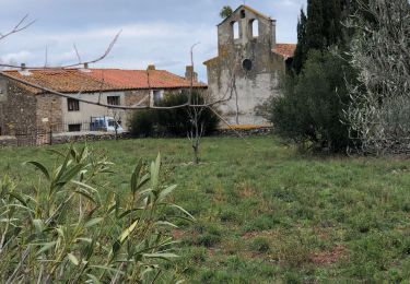
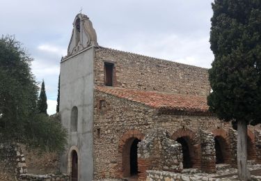
Descente dans correc, sentier balisé, route, puis suivre Chapelle St  Laurent.
Arrive route, à gauche, carrière à dr jusqu'à sommet colline , descente par chapelle.

Elevation profile

Photos

Positioning

Country:
France
Region :
Occitania
Department/Province :
Pyrénées-Orientales
Municipality :
Estagel
Location:
Unknown
Start:(UTM)
475496 ; 4735746 (31T) N.

Trails nearby

Trail Walking Tautavel - Tautavel chemin des bacs - Photo
Walking
jcmartin

Walking

Easy
(3)
Tautavel, Occitania, Pyrénées-Orientales, France
9.5 km | 12.4 km-effort
2h 30min
Yes
Trail Walking Latour-de-France - Latour de France 08/12/2021 - Photo
Walking
andre66

Walking

Medium
Latour-de-France, Occitania, Pyrénées-Orientales, France
12.4 km | 16.2 km-effort
3h 12min
Yes
Trail Walking Tautavel - TAUTAVEL la Tour del Far A/R - Photo
Walking
MarieFrancoise

Walking

Medium
Tautavel, Occitania, Pyrénées-Orientales, France
6.3 km | 11.4 km-effort
3h 55min
Yes
Trail Walking Tautavel - Tautavel -Torre del Far - Photo
Walking
robertperello

Walking

Medium
(1)
Tautavel, Occitania, Pyrénées-Orientales, France
9.5 km | 15.4 km-effort
3h 1min
Yes
Trail Walking Tautavel - La torre del far Tautavel - Photo
Walking
ombrabella

Walking

Tautavel, Occitania, Pyrénées-Orientales, France
9.6 km | 15.6 km-effort
3h 11min
Yes
Trail Walking Estagel - 20201216 Estagel - Calce  - Photo
Walking
ThonyM

Walking

Medium
Estagel, Occitania, Pyrénées-Orientales, France
15.8 km | 22 km-effort
3h 36min
Yes
Trail Walking Tautavel - tautavel - Photo
Walking
fournieralain

Walking

Very easy
Tautavel, Occitania, Pyrénées-Orientales, France
14.6 km | 19.4 km-effort
8h 5min
Yes
Trail Walking Latour-de-France - 66 LATOUR-DE-FRANCE, visite du village, massif de Tourèze et vallée de l'Agly - Photo
Walking
Phidel66

Walking

Medium
Latour-de-France, Occitania, Pyrénées-Orientales, France
8.3 km | 11 km-effort
1h 47min
Yes
Trail Walking Tautavel - mas amiel - Photo
Walking
Fildesir

Walking

Very easy
Tautavel, Occitania, Pyrénées-Orientales, France
19 km | 24 km-effort
6h 15min
Yes


Close
My subscriptions