Trail Walking Lullin - Rd Mont D'Hermonne - Photo
© OpenStreetMap contributors
Length
Length
9.5 km
Max alt
Max alt
1411 m
Uphill gradient
Uphill gradient
477 m
Km-Effort
Km-Effort  
15.9 km
Min alt
Min alt
1122 m
Downhill gradient
Downhill gradient
476 m
Boucle
Boucle
Yes
Creation date :
2015-05-03 00:00:00.0
Updated on :
2015-05-03 00:00:00.0

(1 Reviews)

Walking
Walking
3h30
Difficulty : Easy

Scan this QR Code to open this trail in the SityTrail application

FREE GPS app for hiking

Logo SityTrail SityTrail

IGN / Geographical institutes

Download SityTrail from the App Store Download SityTrail from Google Play

Logo SityTrail SityTrail World

The world is yours!

Download SityTrail from the App Store Download SityTrail from Google Play Download SityTrail on Huawei AppGallery

About

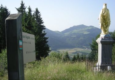
Trail Walking of 9.5 km to be discovered at Auvergne-Rhône-Alpes, Upper Savoy, Lullin. This trail is proposed by christophe7406.

Description

Petite Ballade sympa avec les filles

Elevation profile

Positioning

Country:
France
Region :
Auvergne-Rhône-Alpes
Department/Province :
Upper Savoy
Municipality :
Lullin
Location:
Unknown
Start:(UTM)
308162 ; 5129778 (32T) N.

Comments

Please log in to post a review or rate the element


trace GPS très déformé .Je n'arrive pas à insérer une photo sur le parcours.


Trails nearby

Trail Walking Habère-Poche - Mont Forchat - Habère Poche - Ramble - Photo
Walking
tracegps

Walking

Medium
(2)
Habère-Poche, Auvergne-Rhône-Alpes, Upper Savoy, France
10.7 km | 18.6 km-effort
4h 0min
Yes
Trail Walking Vailly - Pointe d'Ireuse par les Nifflons - Photo
Walking
christophe7406

Walking

Difficult
(1)
Vailly, Auvergne-Rhône-Alpes, Upper Savoy, France
8.5 km | 16.9 km-effort
4h 0min
Yes
Trail Walking Bellevaux - Pointe d'Ireuse - Photo
Walking
DanElise

Walking

Medium
(2)
Bellevaux, Auvergne-Rhône-Alpes, Upper Savoy, France
11.3 km | 23 km-effort
5h 47min
Yes
Trail Walking Habère-Poche - Le mont forchat  - Photo
Walking
colomb24

Walking

Very difficult
Habère-Poche, Auvergne-Rhône-Alpes, Upper Savoy, France
12.4 km | 19.9 km-effort
6h 49min
Yes
Trail Motorbike Orcier - GTA 2018 - ETAPE 11 - Photo
Motorbike
lagardienne

Motorbike

Easy
Orcier, Auvergne-Rhône-Alpes, Upper Savoy, France
208 km | 247 km-effort
9h 0min
No
Trail Running Bellevaux - Allobroges2016_BZH74 - Photo
Running
BZH74

Running

Very difficult
(1)
Bellevaux, Auvergne-Rhône-Alpes, Upper Savoy, France
59 km | 119 km-effort
12h 0min
Yes
Trail Running Bellevaux - Allobroges 63 - Photo
Running
BZH74

Running

Difficult
(1)
Bellevaux, Auvergne-Rhône-Alpes, Upper Savoy, France
63 km | 127 km-effort
14h 0min
Yes
Trail Snowshoes Bellevaux - vers tres le saix - Photo
Snowshoes
michelpratesi

Snowshoes

Medium
(1)
Bellevaux, Auvergne-Rhône-Alpes, Upper Savoy, France
7.2 km | 13.1 km-effort
4h 18min
No
Trail Walking Draillant - Col des moises et les oratoires  - Photo
Walking
dragonfr67

Walking

Easy
Draillant, Auvergne-Rhône-Alpes, Upper Savoy, France
9 km | 15.1 km-effort
3h 48min
Yes


Close
My subscriptions