


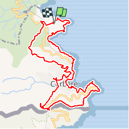


15.1 km | 22 km-effort


User


FREE GPS app for hiking
 SityTrail
IGN / Geographical institutes
SityTrail World
The world is yours!
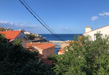
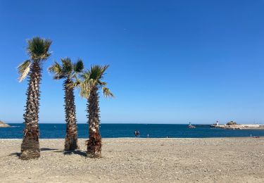
Trail Walking of 14 km to be discovered at Occitania, Pyrénées-Orientales, Cerbère. This trail is proposed by jeff66.
66 CERBÈRE - cap peyrefite, Sentier littoral, camping, village de vacances, anse de Terrimbo. Longer la Voie ferrée, cap Canadell, rentrer dans cerbère par la RD914, avenue du docteur Parcé, cimetiere cap cerbère, phare solaire, Cap Cerbera, frontière, mémorial de l'exil, rejoindre RN114, tunnel sous la gare ferroviaire internationale, rues de la Fareille et du pic Gallines, rue Raoul Dufy, mas Nadal, la Solana, au point d'eau DFCI 323 prendre à droite prendre piste DFCI AL65 puis AL63, rejoindre la RN114, puis la traverser vers le centre héliomarin, prendre le pont qui enjambe la voie ferrée, pour arriver au parking du Camping


52 photos in total. Please click on a photo to see them all in the gallery.

Walking

Walking

Walking
Walking
Walking
Walking
Walking
Walking
Très beau parcours, mais le tout dernier tronçon n'existe plus depuis un incendie l'an dernier: 500 M de progression dans les chardons et les ronces ... Pensez à un détour.