


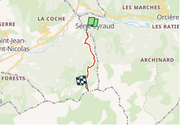

6.3 km | 9.9 km-effort


User


FREE GPS app for hiking
 SityTrail
IGN / Geographical institutes
SityTrail World
The world is yours!
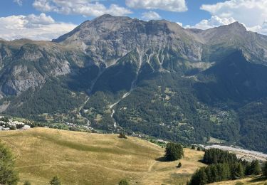
Trail Snowshoes of 5 km to be discovered at Provence-Alpes-Côte d'Azur, Hautes-Alpes, Saint-Jean-Saint-Nicolas. This trail is proposed by motardes04.
Départ peu enneigé sur le chemin, heureusement qu'il y a les feuilles ! nous mettons les crampons arrivés dans le champ en replat, car la neige a bien regelé durant la nuit. On est directement sur la (mince) sous-couche. Reste de la montée sans histoire !
Walking

Walking
Walking
Walking

Walking
Walking
Walking

Snowshoes
Walking