5.9 km | 8.2 km-effort
Terre des Alpes 60
tracegps
User
Length
58 km
Max alt
2111 m
Uphill gradient
2449 m
Km-Effort
91 km
Min alt
773 m
Downhill gradient
2454 m
Boucle
Yes
Creation date :
2014-12-10 00:00:00.0
Updated on :
2014-12-10 00:00:00.0
6h00
Difficulty : Very difficult
FREE GPS app for hiking
About
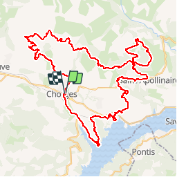
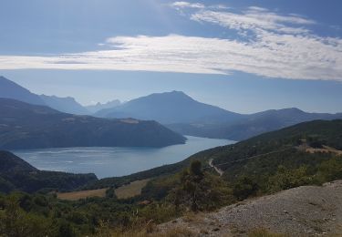
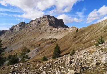
Trail Mountain bike of 58 km to be discovered at Provence-Alpes-Côte d'Azur, Hautes-Alpes, Chorges. This trail is proposed by tracegps.
Description
Parcours super, mais attention prise du télésiège à Realon , sinon zapper la partie Realon !!
Positioning
Country:
France
Region :
Provence-Alpes-Côte d'Azur
Department/Province :
Hautes-Alpes
Municipality :
Chorges
Location:
Unknown
Start:(Dec)
Start:(UTM)
283922 ; 4936117 (32T) N.
Comments
Trails nearby
Chanteloube et lac de Serre Ponçon
Walking
Very easy
(2)
Chorges,
Provence-Alpes-Côte d'Azur,
Hautes-Alpes,
France
1h 47min
Yes
clôt c l'avais sur fein
Walking
Very easy
(2)
Chorges,
Provence-Alpes-Côte d'Azur,
Hautes-Alpes,
France
8 km | 12.6 km-effort
2h 24min
Yes
Les Parias et la Pousterle par le col de Chorges
Walking
Medium
Chorges,
Provence-Alpes-Côte d'Azur,
Hautes-Alpes,
France
15.4 km | 32 km-effort
6h 18min
Yes
Montagne du Ruban
Walking
Easy
(2)
Chorges,
Provence-Alpes-Côte d'Azur,
Hautes-Alpes,
France
11 km | 17.4 km-effort
3h 39min
No
CHORGES camping clé des champs Cantheloube retour par le nord
Walking
Easy
Chorges,
Provence-Alpes-Côte d'Azur,
Hautes-Alpes,
France
8.7 km | 12.1 km-effort
2h 44min
Yes
Bois du Ruban (Clot Clavary - crête du Ruban)
Walking
Easy
Chorges,
Provence-Alpes-Côte d'Azur,
Hautes-Alpes,
France
12.1 km | 19.3 km-effort
3h 52min
Yes
Chorges montagne du bois du Ruban
Walking
Medium
Chorges,
Provence-Alpes-Côte d'Azur,
Hautes-Alpes,
France
10.7 km | 17 km-effort
3h 52min
Yes
le tour du lac de Serre Ponçon
Electric bike
Medium
Chorges,
Provence-Alpes-Côte d'Azur,
Hautes-Alpes,
France
83 km | 110 km-effort
4h 54min
No
Circuit Col de Chorges/Tête des Parias/La Pousterlle/Col de la Gardette. 27/0...
Walking
Very difficult
Chorges,
Provence-Alpes-Côte d'Azur,
Hautes-Alpes,
France
10.9 km | 24 km-effort
8h 32min
Yes