Trail Walking Saint-Amand-les-Eaux - De Saint Amand les Eaux à Bruille - Photo

De Saint Amand les Eaux à Bruille

 tracegps
tracegps

User

© OpenStreetMap contributors
Length
Length
11.7 km
Max alt
Max alt
53 m
Uphill gradient
Uphill gradient
104 m
Km-Effort
Km-Effort  
13.2 km
Min alt
Min alt
16 m
Downhill gradient
Downhill gradient
110 m
Boucle
Boucle
No
Creation date :
2014-12-10 00:00:00.0
Updated on :
2014-12-10 00:00:00.0

(0 Reviews)

Walking
Walking
2h30
Difficulty : Easy

Scan this QR Code to open this trail in the SityTrail application

FREE GPS app for hiking

Logo SityTrail SityTrail

IGN / Geographical institutes

Download SityTrail from the App Store Download SityTrail from Google Play

Logo SityTrail SityTrail World

The world is yours!

Download SityTrail from the App Store Download SityTrail from Google Play Download SityTrail on Huawei AppGallery

About

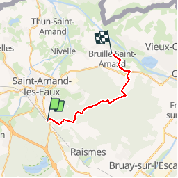
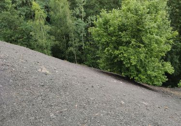
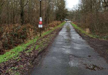
Trail Walking of 11.7 km to be discovered at Hauts-de-France, Nord, Saint-Amand-les-Eaux. This trail is proposed by tracegps.

Description

Gr121 12km de Saint Amand les Eaux à Bruille. Facile a pratiquer tout sport sauf roller cause de terrain non stabilisé.

Elevation profile

Photos

Positioning

Country:
France
Region :
Hauts-de-France
Department/Province :
Nord
Municipality :
Saint-Amand-les-Eaux
Location:
Unknown
Start:(UTM)
531503 ; 5586067 (31U) N.

Trails nearby

Trail Walking Raismes - Circuit du Terril de Sabatier - Photo
Walking
corsinou

Walking

Easy
(1)
Raismes, Hauts-de-France, Nord, France
13 km | 14.9 km-effort
2h 34min
Yes
Trail Walking Saint-Amand-les-Eaux - terril vicoigne - Photo
Walking
papiou

Walking

Easy
Saint-Amand-les-Eaux, Hauts-de-France, Nord, France
8.7 km | 9.7 km-effort
2h 0min
Yes
Trail Walking Saint-Amand-les-Eaux - notre dame d'amour(NDA), propose par VDN - Photo
Walking
papiou

Walking

Medium
Saint-Amand-les-Eaux, Hauts-de-France, Nord, France
9.7 km | 10.6 km-effort
2h 16min
Yes
Trail Walking Raismes - variante de la course des terrils - Photo
Walking
papiou

Walking

Medium
(1)
Raismes, Hauts-de-France, Nord, France
8.8 km | 10 km-effort
2h 10min
Yes
Trail Walking Wallers - Mare goraux - Photo
Walking
xcreator

Walking

Medium
Wallers, Hauts-de-France, Nord, France
6.8 km | 7.5 km-effort
1h 32min
Yes
Trail Walking Nivelle - Nivelle- circuit Nivelle-Mortagne-Chateau l'abbaye - Photo
Walking
papiou

Walking

Easy
(1)
Nivelle, Hauts-de-France, Nord, France
11.5 km | 12.2 km-effort
2h 30min
Yes
Trail Walking Wallers - tour d'Hasnon par forêt et ruisseau - Photo
Walking
papiou

Walking

Easy
Wallers, Hauts-de-France, Nord, France
9.8 km | 10.6 km-effort
2h 8min
Yes
Trail Walking Saint-Amand-les-Eaux - Mesnil, version plus longue - Photo
Walking
papiou

Walking

Easy
Saint-Amand-les-Eaux, Hauts-de-France, Nord, France
9.9 km | 11.1 km-effort
2h 2min
Yes
Trail Walking Saint-Amand-les-Eaux - Mesnil. st Amand - Photo
Walking
papiou

Walking

Easy
Saint-Amand-les-Eaux, Hauts-de-France, Nord, France
8.5 km | 9.6 km-effort
1h 28min
Yes


Close
My subscriptions