Trail Mountain bike Abreschviller - Circuit VTT Saint-Léon - Abreschviller - Photo

Circuit VTT Saint-Léon - Abreschviller

 tracegps
tracegps

User

© OpenStreetMap contributors
Length
Length
11.5 km
Max alt
Max alt
476 m
Uphill gradient
Uphill gradient
261 m
Km-Effort
Km-Effort  
15 km
Min alt
Min alt
297 m
Downhill gradient
Downhill gradient
263 m
Boucle
Boucle
Yes
Creation date :
2014-12-10 00:00:00.0
Updated on :
2014-12-10 00:00:00.0

(1 Reviews)

Mountain bike
Mountain bike
1h30
Difficulty : Medium

Scan this QR Code to open this trail in the SityTrail application

FREE GPS app for hiking

Logo SityTrail SityTrail

IGN / Geographical institutes

Download SityTrail from the App Store Download SityTrail from Google Play

Logo SityTrail SityTrail World

The world is yours!

Download SityTrail from the App Store Download SityTrail from Google Play Download SityTrail on Huawei AppGallery

About

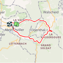
Trail Mountain bike of 11.5 km to be discovered at Grand Est, Moselle, Abreschviller. This trail is proposed by tracegps.

Description

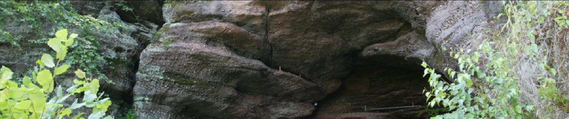
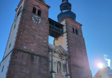
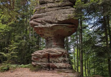
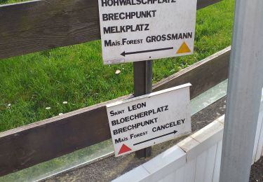
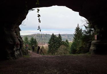
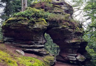
Le circuit part de l’Office de Tourisme en direction du hameau de La Valette. Il pénètre ensuite en forêt et prend la direction de Walscheid en passant par la ferme de Munichshof et du hameau de Saint-Léon où une visite de la grotte, plus grande cavité du massif vosgien, s’impose. Environ 500m après avoir quitté le hameau de Saint-Léon, le tracé se sépare du circuit n°1 par une petite descente assez technique sur la droite. La descente se poursuit ensuite en douceur vers la vallée d’Abreschviller avant de rattraper la route départementale n°44 au niveau du Centre de réadaptation Saint-Luc. Le retour s’effectue par la départementale jusqu’à Abreschviller.

Elevation profile

Photos

Positioning

Country:
France
Region :
Grand Est
Department/Province :
Moselle
Municipality :
Abreschviller
Location:
Unknown
Start:(UTM)
359767 ; 5388856 (32U) N.

Comments

Please log in to post a review or rate the element


Trails nearby

Trail Walking Saint-Quirin - Le circuit des 7 roses - Photo
Walking
VacheKiri67

Walking

Medium
(2)
Saint-Quirin, Grand Est, Moselle, France
17 km | 23 km-effort
5h 3min
Yes
Trail Cycle Abreschviller - Circuit du Donon - Photo
Cycle
tracegps

Cycle

Very difficult
(1)
Abreschviller, Grand Est, Moselle, France
52 km | 67 km-effort
3h 0min
Yes
Trail Mountain bike Abreschviller - sortie VTT du 01092019 Abreschwiller - Photo
Mountain bike
GUIDE
fabwin

Mountain bike

Difficult
Abreschviller, Grand Est, Moselle, France
33 km | 45 km-effort
2h 42min
Yes
Trail Walking Abreschviller - Circulaire de la Roche du Diable - Abreschviller - Photo
Walking
xtislair

Walking

Difficult
(1)
Abreschviller, Grand Est, Moselle, France
10.1 km | 14.7 km-effort
3h 20min
Yes
Trail Walking Saint-Quirin - St Quirin et ses 6 roses - Photo
Walking
Bart2015

Walking

Very difficult
Saint-Quirin, Grand Est, Moselle, France
18.7 km | 25 km-effort
5h 41min
Yes
Trail On foot Saint-Quirin - Le Canceley, le Grand Rommelstein et le Rocher du Calice - Photo
On foot
Mich&Agnès

On foot

Easy
Saint-Quirin, Grand Est, Moselle, France
12.5 km | 19.7 km-effort
4h 29min
Yes
Trail Walking Walscheid - walscheid club vosgien - Photo
Walking
Dorlene.mehl

Walking

Medium
Walscheid, Grand Est, Moselle, France
16.2 km | 22 km-effort
4h 17min
Yes
Trail Walking Walscheid - 2022-03-13 09:09 - Photo
Walking
nfranche

Walking

Very difficult
Walscheid, Grand Est, Moselle, France
16.4 km | 23 km-effort
5h 16min
Yes
Trail Walking Abreschviller - 20210909_rando_MCA_Abreschwiller_Walscheid - Photo
Walking
nfranche

Walking

Very difficult
Abreschviller, Grand Est, Moselle, France
15.6 km | 24 km-effort
5h 23min
Yes


Close
My subscriptions