


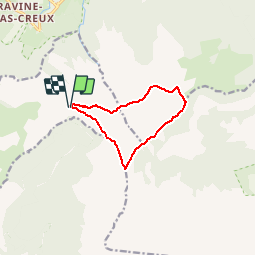

11.4 km | 13.7 km-effort


User


FREE GPS app for hiking
 SityTrail
IGN / Geographical institutes
SityTrail World
The world is yours!
Trail Walking of 12.3 km to be discovered at Réunion, Unknown, Le Tampon. This trail is proposed by JPLEF.
tracé FFRP

Other activity

Walking

Walking

Walking

Walking

Walking
Walking
Walking
Walking
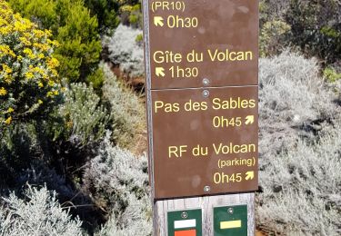
rando peu agréable seul passage très beau le long de la falaise de la rivière de l l'est