Trail Walking Wasserbourg - Au pied du Petit Ballon par le sentier Hertzog - Photo

Au pied du Petit Ballon par le sentier Hertzog

 sit68000
sit68000

User

© OpenStreetMap contributors
Length
Length
5.9 km
Max alt
Max alt
1157 m
Uphill gradient
Uphill gradient
265 m
Km-Effort
Km-Effort  
9.4 km
Min alt
Min alt
912 m
Downhill gradient
Downhill gradient
270 m
Boucle
Boucle
Yes
Creation date :
2020-08-23 12:47:42.064
Updated on :
2020-08-24 06:02:34.508

(0 Reviews)

Walking
Walking
2h05
Difficulty : Very easy

Scan this QR Code to open this trail in the SityTrail application

FREE GPS app for hiking

Logo SityTrail SityTrail

IGN / Geographical institutes

Download SityTrail from the App Store Download SityTrail from Google Play

Logo SityTrail SityTrail World

The world is yours!

Download SityTrail from the App Store Download SityTrail from Google Play Download SityTrail on Huawei AppGallery

About

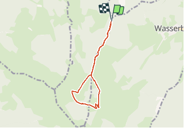
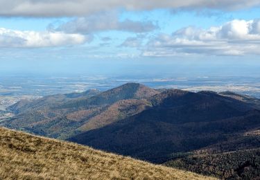
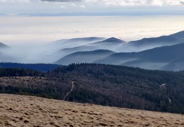
Trail Walking of 5.9 km to be discovered at Grand Est, Haut-Rhin, Wasserbourg. This trail is proposed by sit68000.

Description

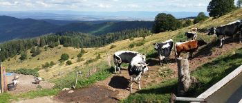
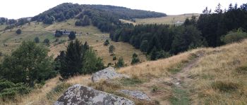
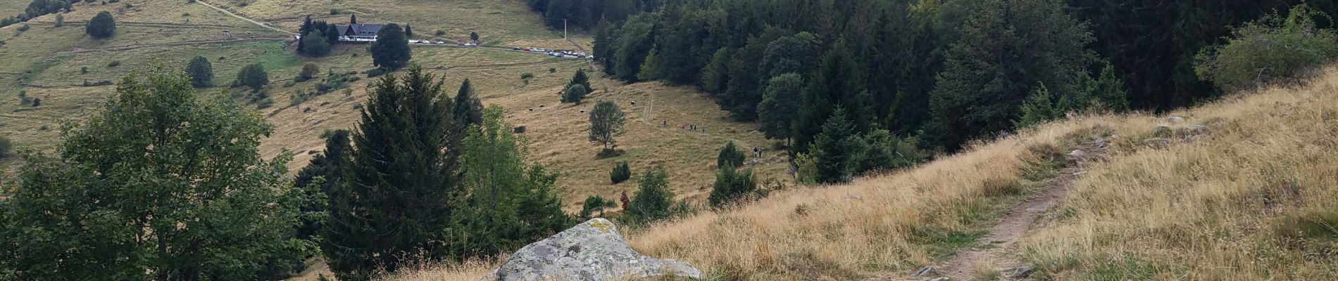
Départ depuis un petit parking en bord de route. Prendre le beau sentier Hertzog, triangle jaune, en direction du sud vers le Petit Ballon. Passage par un belvédère puis arrivée à la ferme auberge du Buchwald. Continuer la montée. Ensuite faire demi-tour par la forêt pour éviter le grand parking. Passage par la ferme auberge du Kahlenwasen puis retour par le sentier Hertzog.

Elevation profile

Photos

Points of interest

Point of interest Wasserbourg - Vue depuis la ferme auberge du Buchawald - Photo
sit68000
Point of interest Wasserbourg - Belvédère Hertzog - Photo
sit68000
WASSERBOURG 

Positioning

Country:
France
Region :
Grand Est
Department/Province :
Haut-Rhin
Municipality :
Wasserbourg
Location:
Unknown
Start:(UTM)
361112 ; 5318485 (32U) N.

Trails nearby

Trail Walking Lautenbach - Tour du Petit Ballon - Photo
Walking
VacheKiri67

Walking

Medium
(1)
Lautenbach, Grand Est, Haut-Rhin, France
12.7 km | 20 km-effort
4h 46min
Yes
Trail Walking Munster - De Munster aux 3 Fours (Aller) - Munster - Photo
Walking
tracegps

Walking

Difficult
(1)
Munster, Grand Est, Haut-Rhin, France
14.8 km | 27 km-effort
5h 0min
No
Trail Walking Linthal - Tour de la grande Vallée de Munster (refuge du Hilsen - Munster) - Photo
Walking
tracegps

Walking

Difficult
(1)
Linthal, Grand Est, Haut-Rhin, France
18.1 km | 24 km-effort
5h 0min
No
Trail Walking Munster - 19.06.13.Munster  - Photo
Walking
ROPPJP

Walking

Very easy
(1)
Munster, Grand Est, Haut-Rhin, France
7.3 km | 10.6 km-effort
2h 10min
Yes
Trail Mountain bike Metzeral - Sentier des Névés - Photo
Mountain bike
tracegps

Mountain bike

Very difficult
(1)
Metzeral, Grand Est, Haut-Rhin, France
33 km | 52 km-effort
6h 0min
Yes
Trail Walking Rouffach - suuntoapp-Hiking-2023-10-22T08-43-15Z - Photo
Walking
GUIDE
holtzv

Walking

Medium
Rouffach, Grand Est, Haut-Rhin, France
19 km | 33 km-effort
7h 34min
Yes
Trail On foot Wasserbourg - Boenlesgrab - Drei Schöpf - Bannwald - Chalet St Hubert - Brunnemaëttlé - Wassmatt - Hansen et retour - Photo
On foot
patrickbeyrath

On foot

Medium
(1)
Wasserbourg, Grand Est, Haut-Rhin, France
10.2 km | 14.2 km-effort
Unknown
Yes
Trail Walking Wasserbourg - SityTrail - Boenlesgrab- Strohberg - Photo
Walking

Walking

Difficult
(1)
Wasserbourg, Grand Est, Haut-Rhin, France
9.6 km | 15.1 km-effort
3h 0min
Yes
Trail Walking Sondernach - 2020-01-02 Marche Landersen Petit Ballon - Photo
Walking
GUIDE
holtzv

Walking

Difficult
Sondernach, Grand Est, Haut-Rhin, France
17.6 km | 28 km-effort
3h 4min
Yes


Close
My subscriptions