Trail Walking Belforêt-en-Perche - chemin chêne école fourneaux  - Photo

chemin chêne école fourneaux

 Krissray
Krissray

User

© OpenStreetMap contributors
Length
Length
3.4 km
Max alt
Max alt
217 m
Uphill gradient
Uphill gradient
96 m
Km-Effort
Km-Effort  
4.7 km
Min alt
Min alt
138 m
Downhill gradient
Downhill gradient
93 m
Boucle
Boucle
Yes
Creation date :
2022-08-12 07:38:30.704
Updated on :
2022-08-12 08:38:25.018

(1 Reviews)

Walking
Walking
57m
Difficulty : Easy

Scan this QR Code to open this trail in the SityTrail application

FREE GPS app for hiking

Logo SityTrail SityTrail

IGN / Geographical institutes

Download SityTrail from the App Store Download SityTrail from Google Play

Logo SityTrail SityTrail World

The world is yours!

Download SityTrail from the App Store Download SityTrail from Google Play Download SityTrail on Huawei AppGallery

About

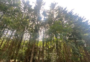
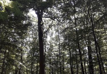
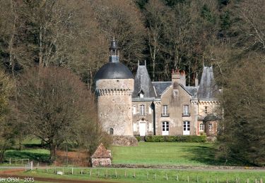
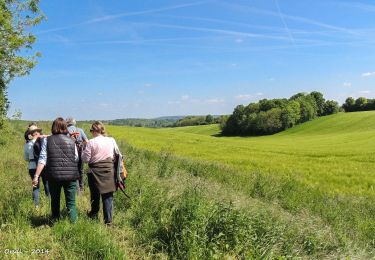
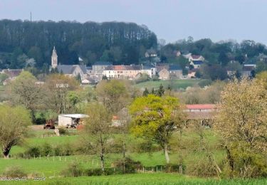
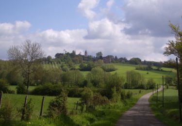
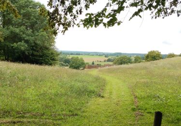
Trail Walking of 3.4 km to be discovered at Normandy, Orne, Belforêt-en-Perche. This trail is proposed by Krissray.

Description

chêne école diago droite descente fourneaux droite chemin à gauche coteau retou

Elevation profile

Positioning

Country:
France
Region :
Normandy
Department/Province :
Orne
Municipality :
Belforêt-en-Perche
Location:
Origny-le-Butin
Start:(UTM)
312536 ; 5361720 (31U) N.

Comments

Please log in to post a review or rate the element


pas fait exprès !!!


Trails nearby

Trail Walking Belforêt-en-Perche - La Perrière, forêt et village - Photo
Walking
jeannine grandjean

Walking

Difficult
Belforêt-en-Perche, Normandy, Orne, France
11.1 km | 13.8 km-effort
3h 8min
Yes
Trail Walking Belforêt-en-Perche - le chêne de l'école - Photo
Walking
fournieralain

Walking

Very easy
Belforêt-en-Perche, Normandy, Orne, France
15.7 km | 19.7 km-effort
6h 47min
Yes
Trail Walking Belforêt-en-Perche -  La Perrière - Saint-Germain-de-la-Coudre via Bellême (TCP) 28 km - Photo
Walking

Walking

Medium
Belforêt-en-Perche, Normandy, Orne, France
28 km | 35 km-effort
7h 16min
No
Trail Walking Belforêt-en-Perche - La Perrière - Saint-Germain-de-la-Coudre via Igé (TCP) 27 km - Photo
Walking

Walking

Easy
Belforêt-en-Perche, Normandy, Orne, France
27 km | 33 km-effort
7h 2min
No
Trail Walking Belforêt-en-Perche - La Perrière - Mortagne-au-Perche (TCP) 29 km - Photo
Walking

Walking

Difficult
Belforêt-en-Perche, Normandy, Orne, France
29 km | 34 km-effort
7h 18min
No
Trail Walking Belforêt-en-Perche - La Perrière : village millénaire - Photo
Walking
tracegps

Walking

Medium
Belforêt-en-Perche, Normandy, Orne, France
11.1 km | 14 km-effort
3h 0min
Yes
Trail Walking Belforêt-en-Perche - la perrière par la forêt  - Photo
Walking
Krissray

Walking

Medium
Belforêt-en-Perche, Normandy, Orne, France
5.6 km | 7.6 km-effort
1h 45min
Yes
Trail Walking Belforêt-en-Perche - fourneaux gr jusqu'au ruisseau - Photo
Walking
Krissray

Walking

Medium
Belforêt-en-Perche, Normandy, Orne, France
5 km | 6.7 km-effort
1h 15min
Yes
Trail Car Belforêt-en-Perche - 2023-12-6 Bellême VduP - Photo
Car
patrick2m

Car

Belforêt-en-Perche, Normandy, Orne, France
47 km | 56 km-effort
2h 48min
No


Close
My subscriptions