Trail Horseback riding Hauteluce - BEAUFORTAIN - Photo
 Sefi78
Sefi78

User

© OpenStreetMap contributors
Length
Length
117 km
Max alt
Max alt
2392 m
Uphill gradient
Uphill gradient
5342 m
Km-Effort
Km-Effort  
189 km
Min alt
Min alt
724 m
Downhill gradient
Downhill gradient
5307 m
Boucle
Boucle
No
Creation date :
2023-08-01 19:34:22.443
Updated on :
2023-08-01 19:51:15.6

(0 Reviews)

Horseback riding
Horseback riding
24h48
Difficulty : Very difficult

Scan this QR Code to open this trail in the SityTrail application

FREE GPS app for hiking

Logo SityTrail SityTrail

IGN / Geographical institutes

Download SityTrail from the App Store Download SityTrail from Google Play

Logo SityTrail SityTrail World

The world is yours!

Download SityTrail from the App Store Download SityTrail from Google Play Download SityTrail on Huawei AppGallery

About

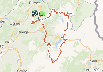
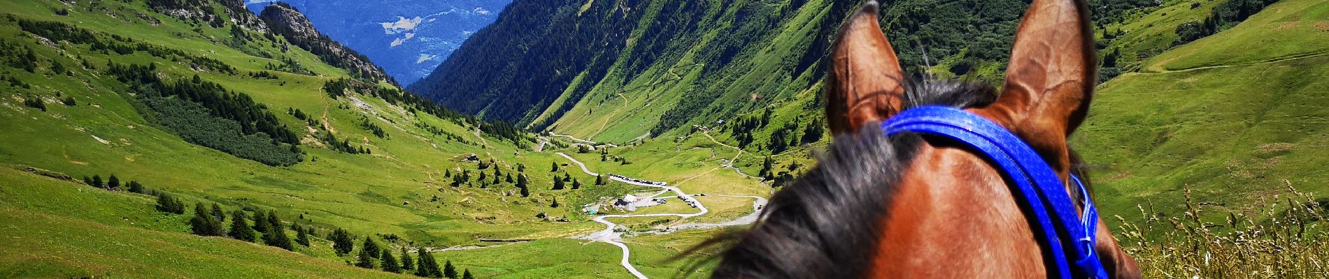
Trail Horseback riding of 117 km to be discovered at Auvergne-Rhône-Alpes, Savoy, Hauteluce. This trail is proposed by Sefi78.

Description

Dernière étape non effectuée
Randonnée juillet 2023.
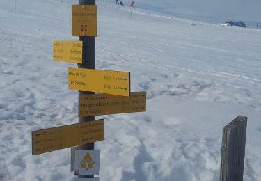
1) Les Saisies, 3 nuits:
_ Centre équestre le Ranch - 15 route des Crêtes -  (les chevaux)
_Hotel le Very -

2) Les Saisies - Roselette
_ Refuge de Roselette

3) Roselette - Chalet du Berger

4) Chalet du Berger - Refuge Econdu

5) Refuge Econdu - Les Saisies

Elevation profile

Photos

Positioning

Country:
France
Region :
Auvergne-Rhône-Alpes
Department/Province :
Savoy
Municipality :
Hauteluce
Location:
Unknown
Start:(UTM)
308243 ; 5070262 (32T) N.

Trails nearby

Trail Walking Hauteluce - sous Bisanne au lac des Saisies - Photo
Walking
syl_34

Walking

Medium
(1)
Hauteluce, Auvergne-Rhône-Alpes, Savoy, France
18.1 km | 28 km-effort
5h 36min
Yes
Trail Cycle Villard-sur-Doron - Boucle Villars le Mont Crest Voland Les Saisies - Photo
Cycle
BrunoMounier

Cycle

Difficult
(1)
Villard-sur-Doron, Auvergne-Rhône-Alpes, Savoy, France
49 km | 74 km-effort
3h 42min
Yes
Trail Mountain bike Villard-sur-Doron - devalbertville - Photo
Mountain bike
biollay

Mountain bike

Difficult
(1)
Villard-sur-Doron, Auvergne-Rhône-Alpes, Savoy, France
18.9 km | 27 km-effort
1h 30min
No
Trail Walking Hauteluce - Hauteluce - Photo
Walking
albertville

Walking

Very easy
(2)
Hauteluce, Auvergne-Rhône-Alpes, Savoy, France
4.1 km | 7.4 km-effort
1h 54min
Yes
Trail Walking Hauteluce - Mont Clocher - Photo
Walking
aglagla5

Walking

Very easy
(2)
Hauteluce, Auvergne-Rhône-Alpes, Savoy, France
7.3 km | 10.4 km-effort
1h 47min
Yes
Trail Walking Hauteluce - Croix de Coste - Mont Bisanne - Photo
Walking
GuyVachet

Walking

Very difficult
Hauteluce, Auvergne-Rhône-Alpes, Savoy, France
13.6 km | 23 km-effort
5h 6min
Yes
Trail Snowshoes Hauteluce - Col des Saisies - Croix de la Coste - Signal de Bisanne - Photo
Snowshoes
ranchoup

Snowshoes

Difficult
Hauteluce, Auvergne-Rhône-Alpes, Savoy, France
15.3 km | 24 km-effort
6h 46min
Yes
Trail Walking Hauteluce - Mont Clocher et Combe de la Douce - Photo
Walking
GuyVachet

Walking

Very difficult
Hauteluce, Auvergne-Rhône-Alpes, Savoy, France
13.5 km | 19.4 km-effort
4h 24min
Yes
Trail Walking Hauteluce - val d arly mont clocher - Photo
Walking
anniediot

Walking

Very easy
(1)
Hauteluce, Auvergne-Rhône-Alpes, Savoy, France
9.6 km | 13.4 km-effort
3h 35min
Yes


Close
My subscriptions