Trail Walking Aspres-sur-Buëch - Boucle Col du Pignon par les Blaches - Photo

Boucle Col du Pignon par les Blaches

 rigol05
rigol05

User

© OpenStreetMap contributors
Length
Length
9.1 km
Max alt
Max alt
897 m
Uphill gradient
Uphill gradient
253 m
Km-Effort
Km-Effort  
12.5 km
Min alt
Min alt
762 m
Downhill gradient
Downhill gradient
258 m
Boucle
Boucle
No
Creation date :
2024-02-02 12:30:40.901
Updated on :
2024-02-05 11:02:59.384

(0 Reviews)

Walking
Walking
2h49
Difficulty : Medium

Scan this QR Code to open this trail in the SityTrail application

FREE GPS app for hiking

Logo SityTrail SityTrail

IGN / Geographical institutes

Download SityTrail from the App Store Download SityTrail from Google Play

Logo SityTrail SityTrail World

The world is yours!

Download SityTrail from the App Store Download SityTrail from Google Play Download SityTrail on Huawei AppGallery

About

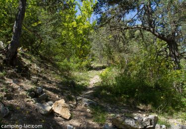
Trail Walking of 9.1 km to be discovered at Provence-Alpes-Côte d'Azur, Hautes-Alpes, Aspres-sur-Buëch. This trail is proposed by rigol05.

Description

Sortie du 02 /02/2024
Itinéraire intéressant, hésitation du départ, le sentier envisagé n'est plus existant, il est  envahit par la végétation. La suite du parcours alternance de pistes et sentiers avec deux belles montées et descentes est agréable. Départ possible à partir des Ourines (point bas)

Elevation profile

Positioning

Country:
France
Region :
Provence-Alpes-Côte d'Azur
Department/Province :
Hautes-Alpes
Municipality :
Aspres-sur-Buëch
Location:
Unknown
Start:(UTM)
719610 ; 4931790 (31T) N.

Trails nearby

Trail Walking Le Saix - R08 La boucle des cascades jaunes - Photo
Walking
GUIDE+

Walking

Very easy
(1)
Le Saix, Provence-Alpes-Côte d'Azur, Hautes-Alpes, France
5.5 km | 10.3 km-effort
2h 10min
Yes
Trail Mountain bike Veynes - VTT29 - Rando famille - Photo
Mountain bike
GUIDE+

Mountain bike

Easy
(1)
Veynes, Provence-Alpes-Côte d'Azur, Hautes-Alpes, France
10.9 km | 13.6 km-effort
54min
Yes
Trail Mountain bike Veynes - VTT14 - Les crêtes de la Longeagne - Photo
Mountain bike
GUIDE+

Mountain bike

Very difficult
(1)
Veynes, Provence-Alpes-Côte d'Azur, Hautes-Alpes, France
39 km | 57 km-effort
3h 15min
Yes
Trail Mountain bike Veynes - VTT03 - Tous les Eygaux - Photo
Mountain bike
GUIDE+

Mountain bike

Medium
(2)
Veynes, Provence-Alpes-Côte d'Azur, Hautes-Alpes, France
23 km | 31 km-effort
1h 31min
Yes
Trail Mountain bike Veynes - VTT02 - Aiguebelle - Photo
Mountain bike
GUIDE+

Mountain bike

Easy
(2)
Veynes, Provence-Alpes-Côte d'Azur, Hautes-Alpes, France
16.7 km | 21 km-effort
1h 23min
Yes
Trail Mountain bike Veynes - VTT01 - Les Eygaux - Photo
Mountain bike
GUIDE+

Mountain bike

Easy
(3)
Veynes, Provence-Alpes-Côte d'Azur, Hautes-Alpes, France
14.1 km | 19.2 km-effort
1h 13min
Yes
Trail Walking Veynes - R10   Le tour des Eygaux - Photo
Walking
GUIDE+

Walking

Very easy
(4)
Veynes, Provence-Alpes-Côte d'Azur, Hautes-Alpes, France
7.8 km | 11.3 km-effort
2h 24min
Yes
Trail Walking Veynes - R09   Le tour de Veynes - Photo
Walking
GUIDE+

Walking

Very easy
(3)
Veynes, Provence-Alpes-Côte d'Azur, Hautes-Alpes, France
9.5 km | 12.3 km-effort
2h 40min
Yes
Trail Walking Le Saix - R07   le fai - Photo
Walking
GUIDE+

Walking

Easy
(4)
Le Saix, Provence-Alpes-Côte d'Azur, Hautes-Alpes, France
5.1 km | 8 km-effort
1h 42min
Yes


Close
My subscriptions