


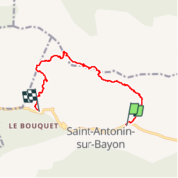


15.8 km | 28 km-effort

User GUIDE


FREE GPS app for hiking
 SityTrail
IGN / Geographical institutes
SityTrail World
The world is yours!
Trail Walking of 6 km to be discovered at Provence-Alpes-Côte d'Azur, Bouches-du-Rhône, Saint-Antonin-sur-Bayon. This trail is proposed by amiral13.
randonnée sportive réservée aux plus aguerris.
une montée face sud de la sainte victoire par le tracé noir, qui demande parfois l'utilisation des mains pour de courts passages (une corde en fond de sac pour aider et rassurer les moins à l'aise peut être la bienvenue). La descente se fera par le pas du moine et le pas du berger (corde bienvenue); Pour les moins téméraires le pas de l'escalette est plus facile, plus long en km, mais pas forcément en durée.
Il s'agit d'un parcours sportif, ne vous fiez pas à sa longueur en km qui bien que faible vous demandera plus de temps que la normale
Nous avons effectué ce parcours avec 3 enfants de 7 ans aguerris et leurs parents. plus le groupe est important, plus grande sera la durée de parcours.
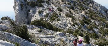
 - Photo 1")
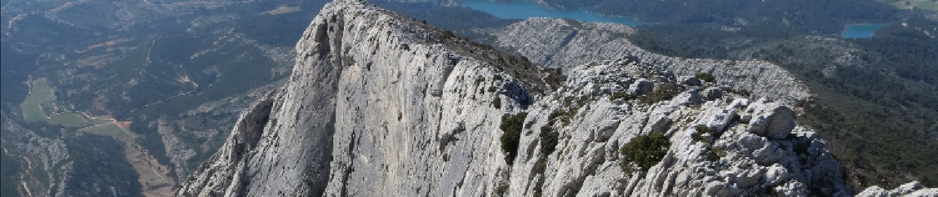
 - Photo 2")

Walking

Walking

Walking

Walking

Walking

On foot

On foot

Walking

Walking