Trail Walking Fillière - Les Molliets-Pertuis-Ablon 10 Mai 2018 - Photo

Les Molliets-Pertuis-Ablon 10 Mai 2018

 Kargil
Kargil

User GUIDE

© OpenStreetMap contributors
Length
Length
18.2 km
Max alt
Max alt
1701 m
Uphill gradient
Uphill gradient
1043 m
Km-Effort
Km-Effort  
32 km
Min alt
Min alt
819 m
Downhill gradient
Downhill gradient
1033 m
Boucle
Boucle
Yes
Creation date :
2018-06-18 20:29:23.873
Updated on :
2018-06-18 20:29:23.873

(0 Reviews)

Walking
Walking
7h06
Difficulty : Difficult

Scan this QR Code to open this trail in the SityTrail application

FREE GPS app for hiking

Logo SityTrail SityTrail

IGN / Geographical institutes

Download SityTrail from the App Store Download SityTrail from Google Play

Logo SityTrail SityTrail World

The world is yours!

Download SityTrail from the App Store Download SityTrail from Google Play Download SityTrail on Huawei AppGallery

About

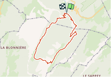
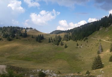
Trail Walking of 18.2 km to be discovered at Auvergne-Rhône-Alpes, Upper Savoy, Fillière. This trail is proposed by Kargil.

Description

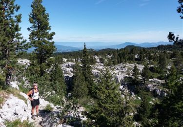
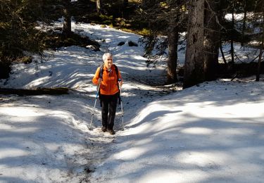
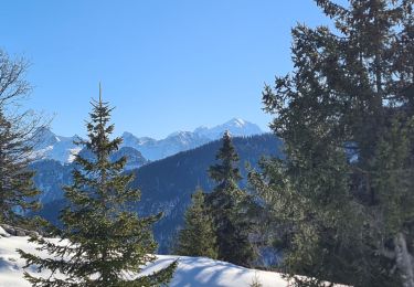
Beau circuit en boucle dont la difficulté augmente en fonction de l'humidité du sentier et de l'enneigement dans une zone de Lappias.
Pour cela quelques passages aériens à franchir avec prudence.
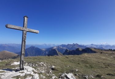
Retour par le passage de la gloire.
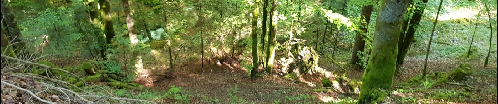
Ne pas hésiter à pousser quelques branches pour suivre le ruisseau en amont du Paccot.
Enlever une bonne heure et un degrés de difficulté en cas de bonnes conditions.

Elevation profile

Photos

Points of interest

Point of interest Dingy-Saint-Clair - Passage de la Gloire - Photo
Kargil
DINGY-SAINT-CLAIR 

Positioning

Country:
France
Region :
Auvergne-Rhône-Alpes
Department/Province :
Upper Savoy
Municipality :
Fillière
Location:
Thorens-Glières
Start:(UTM)
289991 ; 5093283 (32T) N.

Trails nearby

Trail Walking Fillière - LE PARMELAN: ANGLETTAZ - GRANDE GLACIERE - GROTTE DE L'ENFER - LAPIAZ - REFUGE... RETOUR PAR GRAND & PETIT MONTOIR - Photo
Walking
djeepee74

Walking

Difficult
(2)
Fillière, Auvergne-Rhône-Alpes, Upper Savoy, France
9 km | 15.6 km-effort
4h 30min
Yes
Trail Walking Fillière - GLIERES: MONUMENT - CHALETS DES AUGES - GAUTARD - Photo
Walking
djeepee74

Walking

Easy
(1)
Fillière, Auvergne-Rhône-Alpes, Upper Savoy, France
8.8 km | 14.5 km-effort
3h 0min
No
Trail Walking Fillière - 20170806115426 90167 data - Photo
Walking
domcobe

Walking

Easy
(1)
Fillière, Auvergne-Rhône-Alpes, Upper Savoy, France
3.2 km | 8.6 km-effort
1h 53min
No
Trail Walking Fillière - tour parmelan - Photo
Walking
micfor

Walking

Easy
(2)
Fillière, Auvergne-Rhône-Alpes, Upper Savoy, France
12.9 km | 22 km-effort
4h 0min
Yes
Trail Walking Glières-Val-de-Borne - Refuge de Spé - Photo
Walking
Jocelyn74

Walking

Very easy
(1)
Glières-Val-de-Borne, Auvergne-Rhône-Alpes, Upper Savoy, France
3.7 km | 5 km-effort
Unknown
No
Trail Walking Fillière - SOUS DINE PAR LE PAS DU ROC - Photo
Walking
djeepee74

Walking

Difficult
Fillière, Auvergne-Rhône-Alpes, Upper Savoy, France
18.2 km | 34 km-effort
7h 44min
Yes
Trail Walking Glières-Val-de-Borne - GLIERES: TOUR DE LA MONTAGNE DES FRETES  mai 2023 - Photo
Walking
djeepee74

Walking

Difficult
Glières-Val-de-Borne, Auvergne-Rhône-Alpes, Upper Savoy, France
16.6 km | 26 km-effort
6h 30min
Yes
Trail Snowshoes Fillière - CREPON DE  MONTOULIVERT - Photo
Snowshoes
Jean-Paulchoux

Snowshoes

Difficult
Fillière, Auvergne-Rhône-Alpes, Upper Savoy, France
12.1 km | 19.4 km-effort
4h 25min
Yes
Trail Walking Fillière - refuge Patmelan via anglettaz . gd glacière . fontaine du tour . grotte de l enfer  / retour via gd montoir et pt montoir  - Photo
Walking
stef789

Walking

Medium
Fillière, Auvergne-Rhône-Alpes, Upper Savoy, France
10.2 km | 16.1 km-effort
6h 1min
Yes


Close
My subscriptions