Trail Walking Furmeyer - R05 - Le Sentier botanique de Furmeyer, la boucle des Charrières - Photo

R05 - Le Sentier botanique de Furmeyer, la boucle des Charrières

Les Hautes Alpes à découvrir ! GUIDE+

© OpenStreetMap contributors
Length
Length
4.6 km
Max alt
Max alt
1090 m
Uphill gradient
Uphill gradient
256 m
Km-Effort
Km-Effort  
8 km
Min alt
Min alt
850 m
Downhill gradient
Downhill gradient
255 m
Boucle
Boucle
Yes
Creation date :
2018-06-14 19:21:50.429
Updated on :
2019-05-13 19:57:06.754

(0 Reviews)

Walking
Walking
1h40
Difficulty : Very easy

Scan this QR Code to open this trail in the SityTrail application

FREE GPS app for hiking

Logo SityTrail SityTrail

IGN / Geographical institutes

Download SityTrail from the App Store Download SityTrail from Google Play

Logo SityTrail SityTrail World

The world is yours!

Download SityTrail from the App Store Download SityTrail from Google Play Download SityTrail on Huawei AppGallery

About

Trail Walking of 4.6 km to be discovered at Provence-Alpes-Côte d'Azur, Hautes-Alpes, Furmeyer. This trail is proposed by Camping Les Rives du Lac.

Description

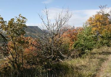
Family hike. It is best to do it starting towards the Northwest for more shaded rise. Remarkable contrast between the southern slopes Provencal style and the northern slopes of Alpine-type. Enjoy the small chapel of Furmeyer. We recommend that you & rsquo; & rsquo go up; the standpoint of the Mine Garcine, where you will find benches to rest !

Elevation profile

Photos

Points of interest

Point of interest Furmeyer - Fontaine - Photo
CampingLesRivesduLac
FURMEYER 
Point of interest Furmeyer - Direction Furmeyer - Photo
CampingLesRivesduLac
Point of interest Furmeyer - Montée au pic de Fayolle - Photo
CampingLesRivesduLac

Positioning

Country:
France
Region :
Provence-Alpes-Côte d'Azur
Department/Province :
Hautes-Alpes
Municipality :
Furmeyer
Location:
Unknown
Start:(UTM)
726936 ; 4935141 (31T) N.

Trails nearby

Trail Mountain bike Veynes - VTT29 - Rando famille - Photo
Mountain bike
GUIDE+

Mountain bike

Easy
(1)
Veynes, Provence-Alpes-Côte d'Azur, Hautes-Alpes, France
10.9 km | 13.6 km-effort
54min
Yes
Trail Mountain bike Veynes - VTT14 - Les crêtes de la Longeagne - Photo
Mountain bike
GUIDE+

Mountain bike

Very difficult
(1)
Veynes, Provence-Alpes-Côte d'Azur, Hautes-Alpes, France
39 km | 57 km-effort
3h 15min
Yes
Trail Mountain bike Veynes - VTT03 - Tous les Eygaux - Photo
Mountain bike
GUIDE+

Mountain bike

Medium
(2)
Veynes, Provence-Alpes-Côte d'Azur, Hautes-Alpes, France
23 km | 31 km-effort
1h 31min
Yes
Trail Mountain bike Veynes - VTT02 - Aiguebelle - Photo
Mountain bike
GUIDE+

Mountain bike

Easy
(2)
Veynes, Provence-Alpes-Côte d'Azur, Hautes-Alpes, France
16.7 km | 21 km-effort
1h 23min
Yes
Trail Mountain bike Veynes - VTT01 - Les Eygaux - Photo
Mountain bike
GUIDE+

Mountain bike

Easy
(3)
Veynes, Provence-Alpes-Côte d'Azur, Hautes-Alpes, France
14.1 km | 19.2 km-effort
1h 13min
Yes
Trail Walking Veynes - R10   Le tour des Eygaux - Photo
Walking
GUIDE+

Walking

Very easy
(4)
Veynes, Provence-Alpes-Côte d'Azur, Hautes-Alpes, France
7.8 km | 11.3 km-effort
2h 24min
Yes
Trail Walking Veynes - R09   Le tour de Veynes - Photo
Walking
GUIDE+

Walking

Very easy
(3)
Veynes, Provence-Alpes-Côte d'Azur, Hautes-Alpes, France
9.5 km | 12.3 km-effort
2h 40min
Yes
Trail Walking Veynes - R06   glaise - Photo
Walking
GUIDE+

Walking

Easy
(1)
Veynes, Provence-Alpes-Côte d'Azur, Hautes-Alpes, France
9.1 km | 14.9 km-effort
3h 4min
Yes
Trail Walking Veynes - R52   Le col de Cuberselle - Photo
Walking
GUIDE+

Walking

Medium
(3)
Veynes, Provence-Alpes-Côte d'Azur, Hautes-Alpes, France
10.8 km | 17.2 km-effort
3h 31min
Yes


Close
My subscriptions