Trail Walking Francillon-sur-Roubion - Le Grand Quinson - Photo
 tracegps
tracegps

User

© OpenStreetMap contributors
Length
Length
6.2 km
Max alt
Max alt
427 m
Uphill gradient
Uphill gradient
158 m
Km-Effort
Km-Effort  
8.4 km
Min alt
Min alt
296 m
Downhill gradient
Downhill gradient
158 m
Boucle
Boucle
Yes
Creation date :
2014-12-10 00:00:00.0
Updated on :
2014-12-10 00:00:00.0

(1 Reviews)

Walking
Walking
2h15
Difficulty : Medium

Scan this QR Code to open this trail in the SityTrail application

FREE GPS app for hiking

Logo SityTrail SityTrail

IGN / Geographical institutes

Download SityTrail from the App Store Download SityTrail from Google Play

Logo SityTrail SityTrail World

The world is yours!

Download SityTrail from the App Store Download SityTrail from Google Play Download SityTrail on Huawei AppGallery

About

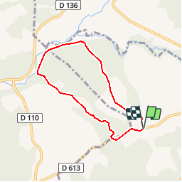
Trail Walking of 6.2 km to be discovered at Auvergne-Rhône-Alpes, Drôme, Francillon-sur-Roubion. This trail is proposed by tracegps.

Description

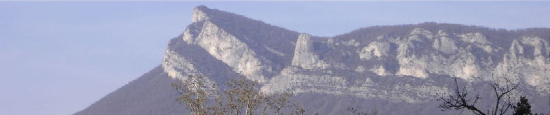
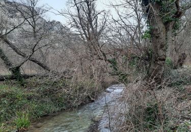
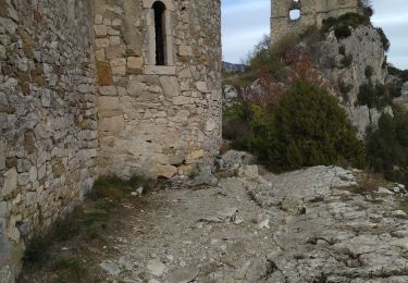
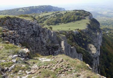
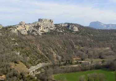
Le Grand Quinson, une promenade panoramique, ça pique les yeux ! Les buis sont vos amis sur cette colline sauvageonne... Vous passerez près des grottes du néolithique, Baume claire et Baume sourde, mais ne vous y aventurez pas...Danger ! Baignade possible dans le Roubion. C'est une rando casse-croûte, plus de détails au gîte du Pré bossu.

Elevation profile

Photos

Positioning

Country:
France
Region :
Auvergne-Rhône-Alpes
Department/Province :
Drôme
Municipality :
Francillon-sur-Roubion
Location:
Unknown
Start:(UTM)
664021 ; 4942657 (31T) N.

Comments

Please log in to post a review or rate the element


sympa mais parfois il faut légèrement s'écarter de l'itinéraire indiqué pour rester sur le chemin.


Trails nearby

Trail Walking Francillon-sur-Roubion - Balade à francillon sur roubion - description et photos - Photo
Walking
bob2023

Walking

Easy
(1)
Francillon-sur-Roubion, Auvergne-Rhône-Alpes, Drôme, France
5 km | 6.7 km-effort
1h 36min
Yes
Trail Walking Saou - roche Colombe - Photo
Walking
bob2023

Walking

Medium
(1)
Saou, Auvergne-Rhône-Alpes, Drôme, France
10.9 km | 16.8 km-effort
3h 58min
Yes
Trail Walking Saou - Saou Lestang 7 km. - Photo
Walking
chancha

Walking

Medium
(1)
Saou, Auvergne-Rhône-Alpes, Drôme, France
6.6 km | 8.7 km-effort
1h 59min
Yes
Trail Walking Saou - Les 3 Becs, le Veyou, le Signal et Rochecourbe - Photo
Walking
tracegps

Walking

Difficult
(3)
Saou, Auvergne-Rhône-Alpes, Drôme, France
18.5 km | 36 km-effort
8h 0min
Yes
Trail Walking Saou - Entre Roc et Estang - Photo
Walking
tracegps

Walking

Medium
(1)
Saou, Auvergne-Rhône-Alpes, Drôme, France
5.2 km | 7.5 km-effort
1h 15min
Yes
Trail Walking Soyans - 26 la repara - Photo
Walking
GUIDE
randodyssée

Walking

Medium
Soyans, Auvergne-Rhône-Alpes, Drôme, France
13.6 km | 20 km-effort
5h 12min
Yes
Trail Walking Rochebaudin - Rochebaudin-Trou du Furet-Serre Gros 16km  - Photo
Walking
GUIDE
thonyc

Walking

Difficult
Rochebaudin, Auvergne-Rhône-Alpes, Drôme, France
15.8 km | 26 km-effort
5h 0min
Yes
Trail Walking Soyans - Soyans 17km - Photo
Walking
GUIDE
thonyc

Walking

Medium
(1)
Soyans, Auvergne-Rhône-Alpes, Drôme, France
15.5 km | 21 km-effort
5h 0min
Yes
Trail Walking Saou - Saou : petite balade en forêt  - Photo
Walking
Jgar

Walking

Medium
Saou, Auvergne-Rhône-Alpes, Drôme, France
7.4 km | 10.9 km-effort
2h 28min
Yes


Close
My subscriptions