tracegps

Offline

Trails

Trail Walking Prades - De Prades à Notre Dame Destours via Sainte Marie des Chazes - Photo
Walking
tracegps

Walking

Medium
Prades, Auvergne-Rhône-Alpes, Haute-Loire, France
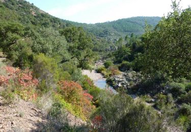
17.7 km | 27 km-effort
6h 0min
Yes
Trail Running Bevons - Tour du Peydiou -  Bevons - Photo
Running
tracegps

Running

Medium
Bevons, Provence-Alpes-Côte d'Azur, Alpes-de-Haute-Provence, France
11.1 km | 17 km-effort
1h 40min
Yes
Trail Walking Bevons - Tour du Peydiou -  Bevons - Photo
Walking
tracegps

Walking

Medium
Bevons, Provence-Alpes-Côte d'Azur, Alpes-de-Haute-Provence, France
11.1 km | 17 km-effort
3h 0min
Yes
Trail Mountain bike Cires-lès-Mello - Cires-lès-Mello, coté Ouest - Photo
Mountain bike
tracegps

Mountain bike

Medium
Cires-lès-Mello, Hauts-de-France, Oise, France
58 km | 69 km-effort
3h 30min
Yes
Trail Running Curel - Les Chaux - Curel  - Photo
Running
tracegps

Running

Difficult
Curel, Provence-Alpes-Côte d'Azur, Alpes-de-Haute-Provence, France
8.5 km | 16.2 km-effort
1h 21min
Yes
Trail Walking Curel - Les Chaux - Curel  - Photo
Walking
tracegps

Walking

Medium
Curel, Provence-Alpes-Côte d'Azur, Alpes-de-Haute-Provence, France
8.5 km | 16.2 km-effort
2h 30min
Yes
Trail Walking Saint-Maurice - Autour du Puy St Romain - Saint-Maurice-ès-Allier - Photo
Walking
tracegps

Walking

Medium
Saint-Maurice, Auvergne-Rhône-Alpes, Puy-de-Dôme, France
12.6 km | 18.3 km-effort
4h 15min
Yes
Trail Walking Monthermé - De Monthermé à la Roche à Sept Heures via le Roc la Tour et la Roche aux Corpias - Photo
Walking
tracegps

Walking

Difficult
Monthermé, Grand Est, Ardennes, France
20 km | 32 km-effort
5h 0min
Yes
Trail Running Asté - Casque de Lhéris depuis Asté - Photo
Running
tracegps

Running

Difficult
Asté, Occitania, Hautespyrenees, France
16.8 km | 34 km-effort
3h 0min
No
Trail Walking Ancelle - Le Piolit (2464 mètres) - Ancelle - Photo
Walking
tracegps

Walking

Difficult
Ancelle, Provence-Alpes-Côte d'Azur, Hautes-Alpes, France
10.1 km | 21 km-effort
4h 0min
Yes
Trail Mountain bike Revin - De Revin à Haybes via la voie verte - Photo
Mountain bike
tracegps

Mountain bike

Difficult
Revin, Grand Est, Ardennes, France
36 km | 43 km-effort
3h 0min
Yes
Trail Walking Le Noyer-en-Ouche - Circuit de Chatel La Lune - Le Noyer en Ouche - Photo
Walking
tracegps

Walking

Medium
(1)
Le Noyer-en-Ouche, Normandy, Eure, France
10.3 km | 11.9 km-effort
2h 30min
Yes
Trail Walking Saint-Hilaire-d'Ozilhan - La Grand Combe St Hilaire d'Ozilhan - Remoulins - Photo
Walking
tracegps

Walking

Medium
Saint-Hilaire-d'Ozilhan, Occitania, Gard, France
9.6 km | 11.3 km-effort
2h 30min
Yes
Trail Walking Marseille - Le Plateau de l'Homme Mort, depuis les Baumettes - Photo
Walking
tracegps

Walking

Medium
Marseille, Provence-Alpes-Côte d'Azur, Bouches-du-Rhône, France
7.9 km | 13 km-effort
3h 45min
Yes
Trail Running Régny - Découverte du viaduc de l'Ecoron - Régny - Photo
Running
tracegps

Running

Difficult
Régny, Auvergne-Rhône-Alpes, Loire, France
11.9 km | 16.2 km-effort
1h 45min
Yes
Trail Walking Régny - Découverte du viaduc de l'Ecoron - Régny - Photo
Walking
tracegps

Walking

Difficult
(2)
Régny, Auvergne-Rhône-Alpes, Loire, France
11.9 km | 16.2 km-effort
3h 0min
Yes
Trail Walking Abriès-Ristolas - Le Tour du Queyras (Le Roux aux Fonds de Cervières) - Photo
Walking
tracegps

Walking

Very difficult
Abriès-Ristolas, Provence-Alpes-Côte d'Azur, Hautes-Alpes, France
16.1 km | 33 km-effort
6h 30min
No
Trail Walking Abriès-Ristolas - Le Tour du Queyras (La Monta - Le Roux). - Photo
Walking
tracegps

Walking

Difficult
Abriès-Ristolas, Provence-Alpes-Côte d'Azur, Hautes-Alpes, France
12.1 km | 25 km-effort
4h 45min
No
Trail Mountain bike Mandelieu-la-Napoule - Tour de l'Estérel - Mandelieu-La-Napoule - Photo
Mountain bike
tracegps

Mountain bike

Difficult
Mandelieu-la-Napoule, Provence-Alpes-Côte d'Azur, Maritime Alps, France
54 km | 76 km-effort
7h 0min
Yes
Trail Walking Molines-en-Queyras - Le Tour du Queyras (Refuge Agnel - La Monta). - Photo
Walking
tracegps

Walking

Medium
Molines-en-Queyras, Provence-Alpes-Côte d'Azur, Hautes-Alpes, France
12.6 km | 19.7 km-effort
4h 30min
No
Trail Mountain bike Salon de Provence - Quatre descentes VTT entre Pelissanne et Aurons - Salon de Provence - Photo
Mountain bike
tracegps

Mountain bike

Difficult
Salon de Provence, Provence-Alpes-Côte d'Azur, Bouches-du-Rhône, France
11.9 km | 15.5 km-effort
2h 30min
Yes

Close
My subscriptions